MyTopo
Bathgate North Dakota US Topo Map
Couldn't load pickup availability
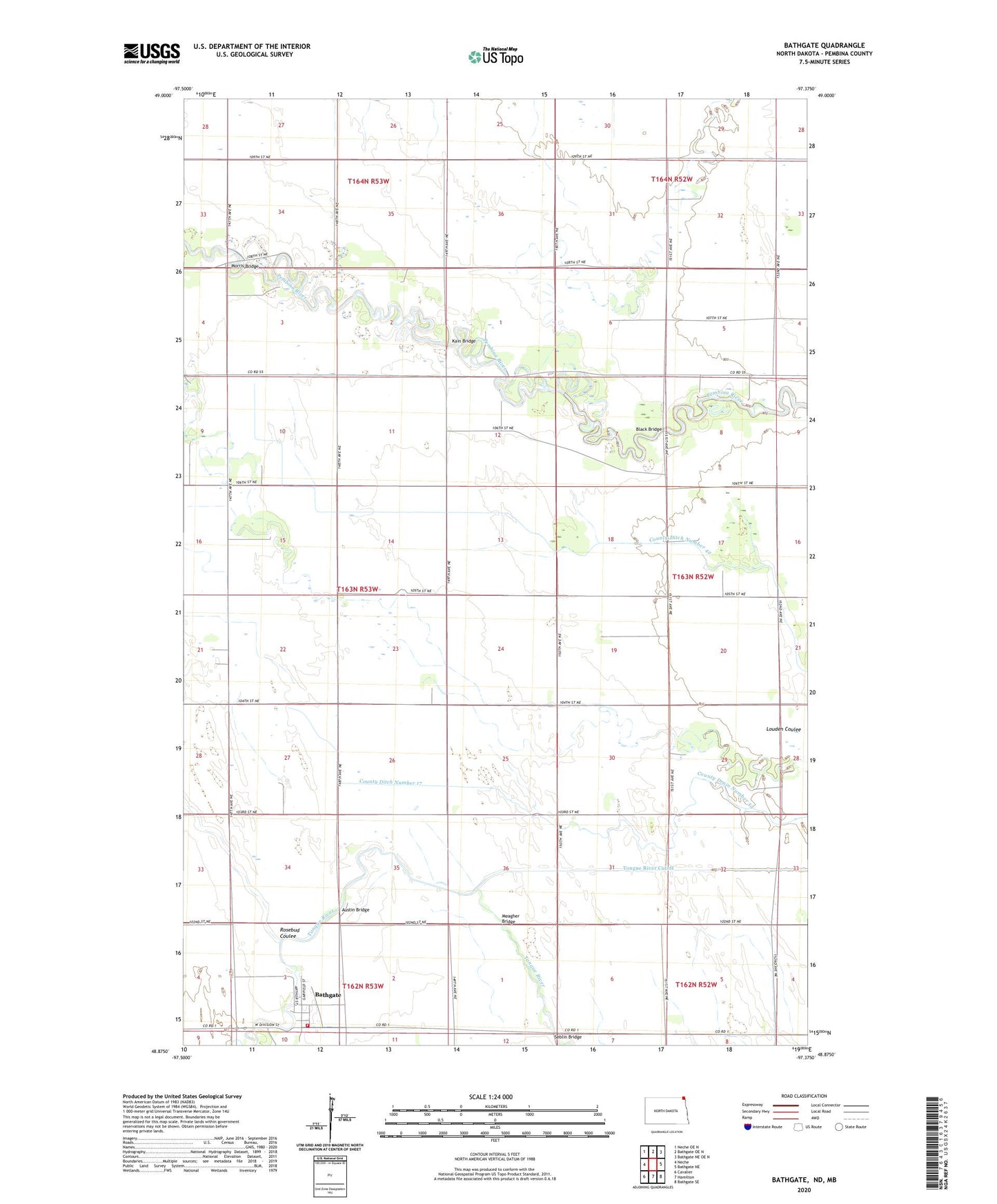
2024 topographic map quadrangle Bathgate in the state of North Dakota. Scale: 1:24000. Based on the newly updated USGS 7.5' US Topo map series, this map is in the following counties: Pembina. The map contains contour data, water features, and other items you are used to seeing on USGS maps, but also has updated roads and other features. This is the next generation of topographic maps. Printed on high-quality waterproof paper with UV fade-resistant inks.
Quads adjacent to this one:
West: Neche
Northwest: Neche OE N
North: Bathgate OE N
Northeast: Bathgate NE OE N
East: Bathgate NE
Southeast: Bathgate SE
South: Hamilton
Southwest: Cavalier
This map covers the same area as the classic USGS quad with code o48097h4.
Contains the following named places: Austin Bridge, Bathgate, Bathgate Fire Department, Bathgate Post Office, Black Bridge, Bonaime Field, City of Bathgate, County Ditch Number 17, County Ditch Number 42, County Drain Number 33, County Drain Number 42, Horsley Airstrip, Kain Bridge, KWBA-TV (Pembina), Meagher Bridge, Morris Bridge, Rosebud Coulee, Seblin Bridge, Tongue River Cutoff, Township of Neche, ZIP Code: 58216