MyTopo
Cavalier North Dakota US Topo Map
Couldn't load pickup availability
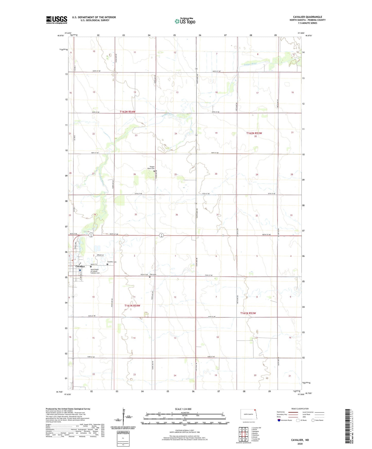
2024 topographic map quadrangle Cavalier in the state of North Dakota. Scale: 1:24000. Based on the newly updated USGS 7.5' US Topo map series, this map is in the following counties: Pembina. The map contains contour data, water features, and other items you are used to seeing on USGS maps, but also has updated roads and other features. This is the next generation of topographic maps. Printed on high-quality waterproof paper with UV fade-resistant inks.
Quads adjacent to this one:
West: Backoo
Northwest: Cavalier NW
North: Neche
Northeast: Bathgate
East: Hamilton
Southeast: Glasston
South: Crystal NE
Southwest: Hensel
This map covers the same area as the classic USGS quad with code o48097g5.
Contains the following named places: Cavalier, Cavalier Cemetery, Cavalier City Hall, Cavalier Public School, City of Cavalier, Magnuson Field, Pembina County, Pembina County Memorial Hospital, Saint Brigid of Ireland Catholic Cemetery, Tongue River Cemetery, Township of Cavalier, Zion Cemetery