MyTopo
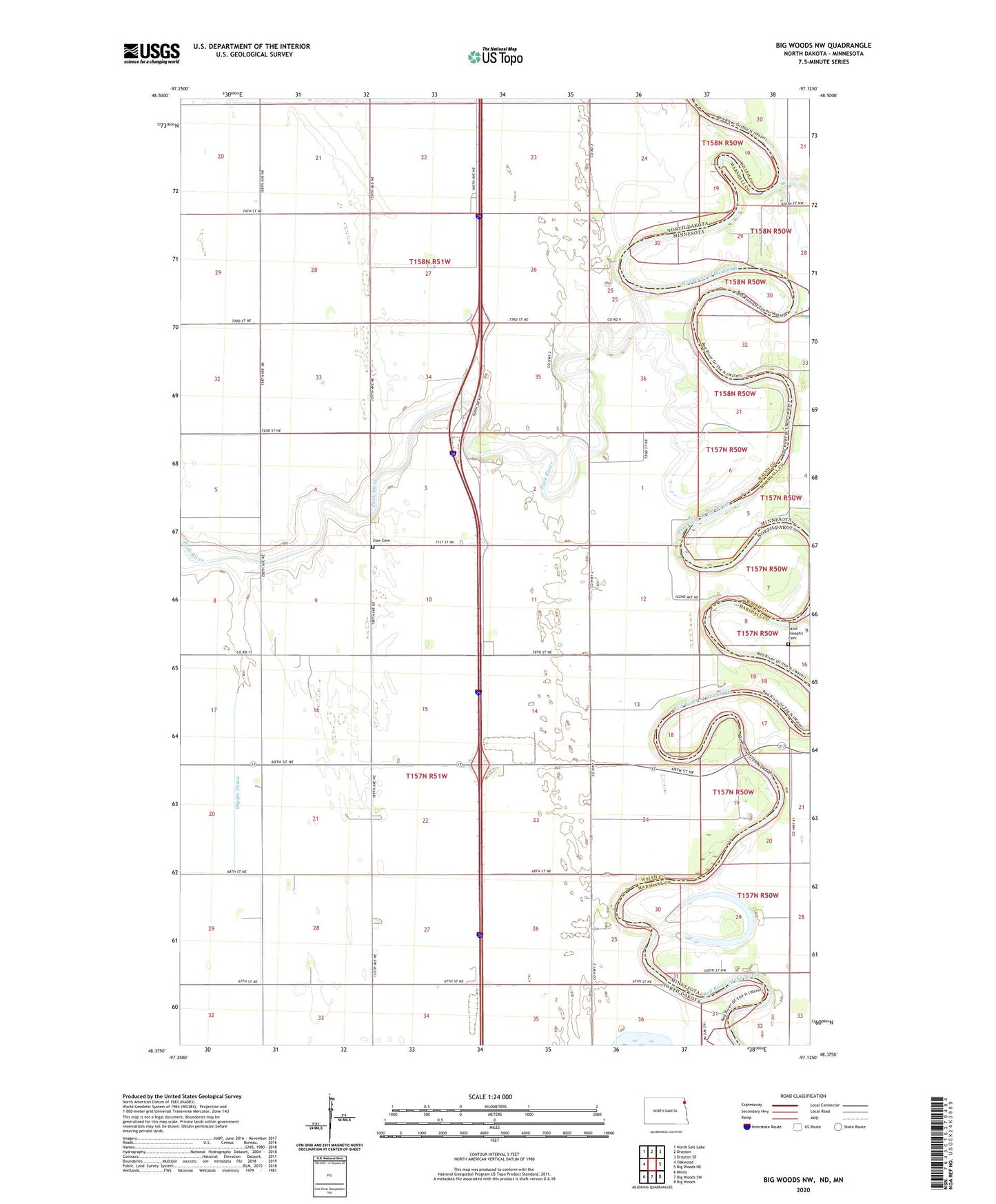
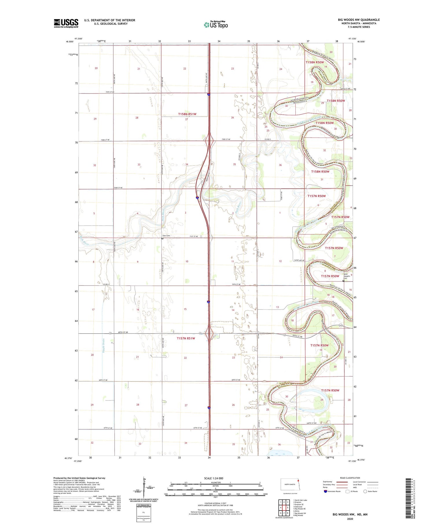
Big Woods NW North Dakota US Topo Map
Couldn't load pickup availability
2020 topographic map quadrangle Big Woods NW in the states of North Dakota, Minnesota. Scale: 1:24000. Based on the newly updated USGS 7.5' US Topo map series, this map is in the following counties: Walsh, Marshall. The map contains contour data, water features, and other items you are used to seeing on USGS maps, but also has updated roads and other features. This is the next generation of topographic maps. Printed on high-quality waterproof paper with UV fade-resistant inks.
Quads adjacent to this one:
West: Oakwood
Northwest: North Salt Lake
North: Drayton
Northeast: Drayton SE
Southeast: Big Woods
South: Big Woods SW
Southwest: Minto
Contains the following named places: Acton, Acton Town Hall, Alexander Henry Rest Area, Dipple Drain, Fork Post Office, Horseshoe Lake, Park River, Saint Andrews, Saint Joseph Church, Saint Joseph's Cemetery, School Number 14, School Number 30, School Number 87, Tamarac River, Township of Acton, Township of Saint Andrews, Zion Cemetery