MyTopo
Drayton SE Minnesota US Topo Map
Couldn't load pickup availability
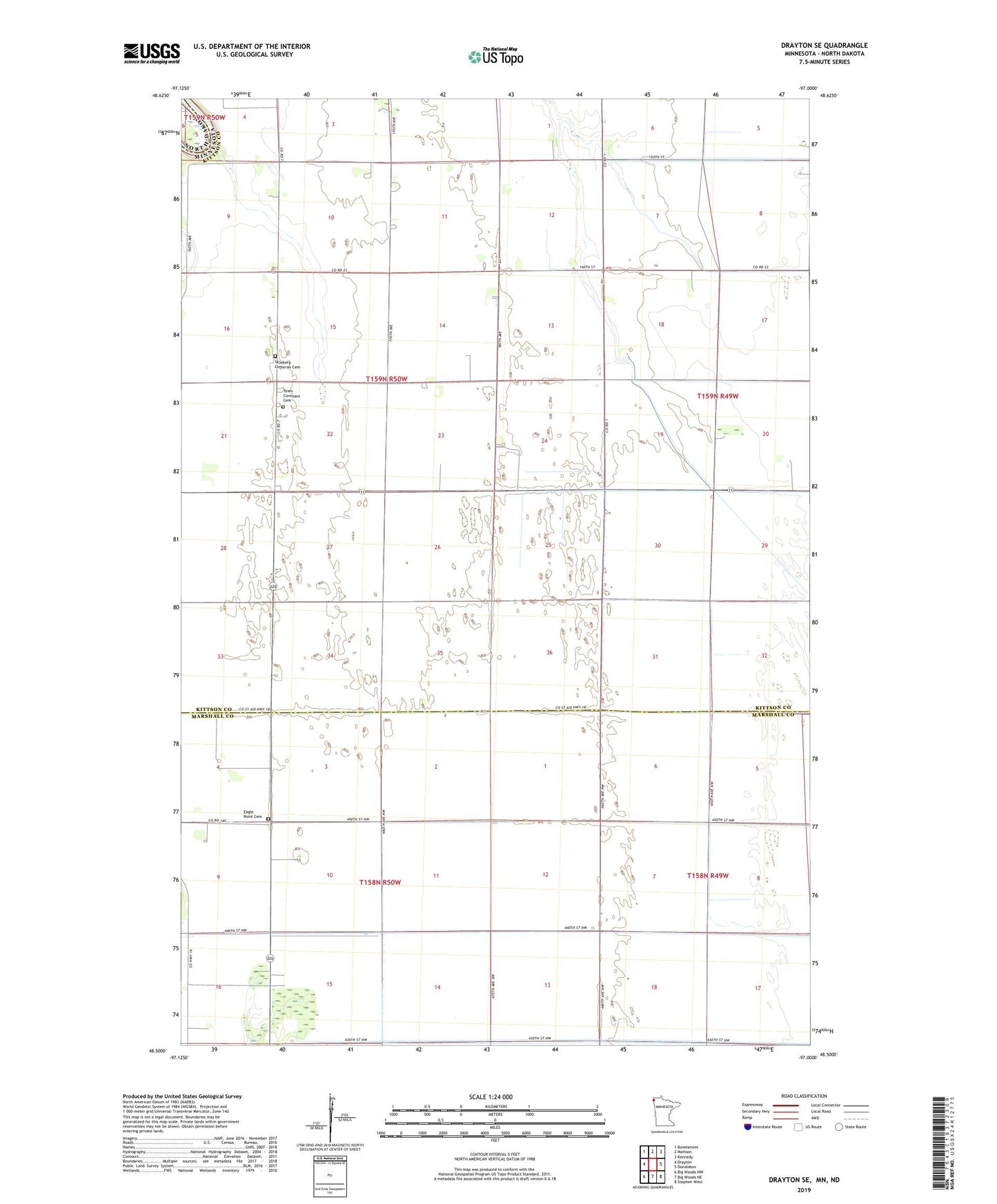
2022 topographic map quadrangle Drayton SE in the state of Minnesota. Scale: 1:24000. Based on the newly updated USGS 7.5' US Topo map series, this map is in the following counties: Kittson, Marshall, Pembina. The map contains contour data, water features, and other items you are used to seeing on USGS maps, but also has updated roads and other features. This is the next generation of topographic maps. Printed on high-quality waterproof paper with UV fade-resistant inks.
Quads adjacent to this one:
West: Drayton
Northwest: Bowesmont
North: Mattson
Northeast: Kennedy
East: Donaldson
Southeast: Stephen West
Southwest: Big Woods NW
Contains the following named places: Central School, Eagle Point Cemetery, Eagle Point Church, Excelsior School, Johnson School, Judicial Ditch Number Eight, Plainview School, Skjeberg Church, Skjeberg Lutheran Cemetery, Skog Post Office, Teien Church, Teien Covenant Cemetery, Teien Post Office, Township of Eagle Point, Township of Teien