MyTopo
Drayton North Dakota US Topo Map
Couldn't load pickup availability
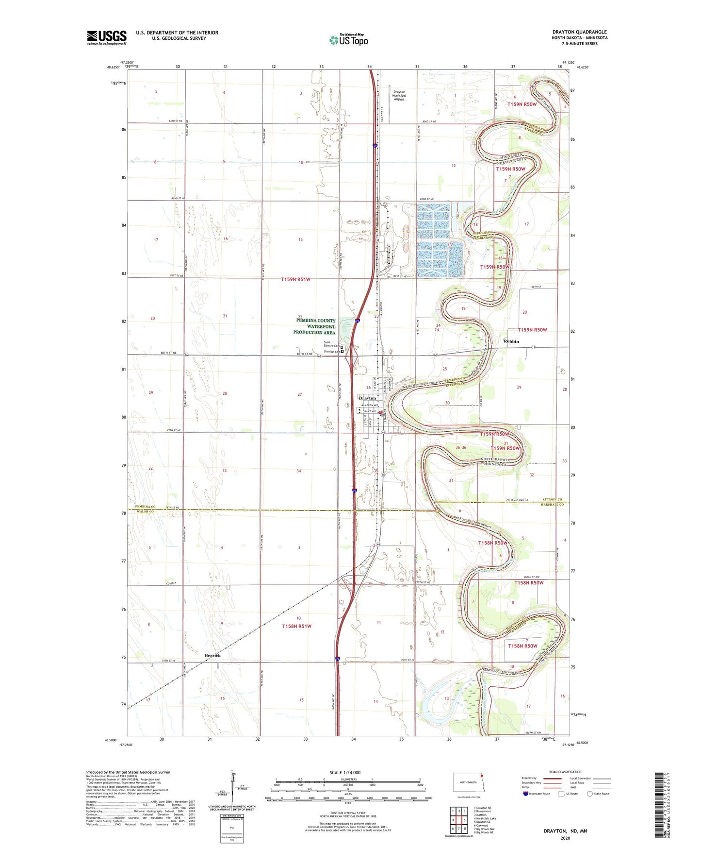
2024 topographic map quadrangle Drayton in the states of North Dakota, Minnesota. Scale: 1:24000. Based on the newly updated USGS 7.5' US Topo map series, this map is in the following counties: Pembina, Walsh, Kittson, Marshall. The map contains contour data, water features, and other items you are used to seeing on USGS maps, but also has updated roads and other features. This is the next generation of topographic maps. Printed on high-quality waterproof paper with UV fade-resistant inks.
Quads adjacent to this one:
West: North Salt Lake
Northwest: Glasston NE
North: Bowesmont
Northeast: Mattson
East: Drayton SE
South: Big Woods NW
Southwest: Oakwood
This map covers the same area as the classic USGS quad with code o48097e2.
Contains the following named places: Blessing Museum, City of Drayton, County Ditch Number 55, Drayton, Drayton Cemetery, Drayton City Hall, Drayton Dam, Drayton Fire and Rescue, Drayton High School, Drayton Municipal Airport, Drayton Post Office, Drayton Volunteer Ambulance, Herrick, Herrick School, Pittsburgh, Red River, Red River of the North-Drayton Dam, Riverside School, Robbin, Robbin Post Office, Saint Andrews Town Hall, Saint Edward Cemetery, Schumacher Park, Township of Drayton, ZIP Code: 58225