MyTopo
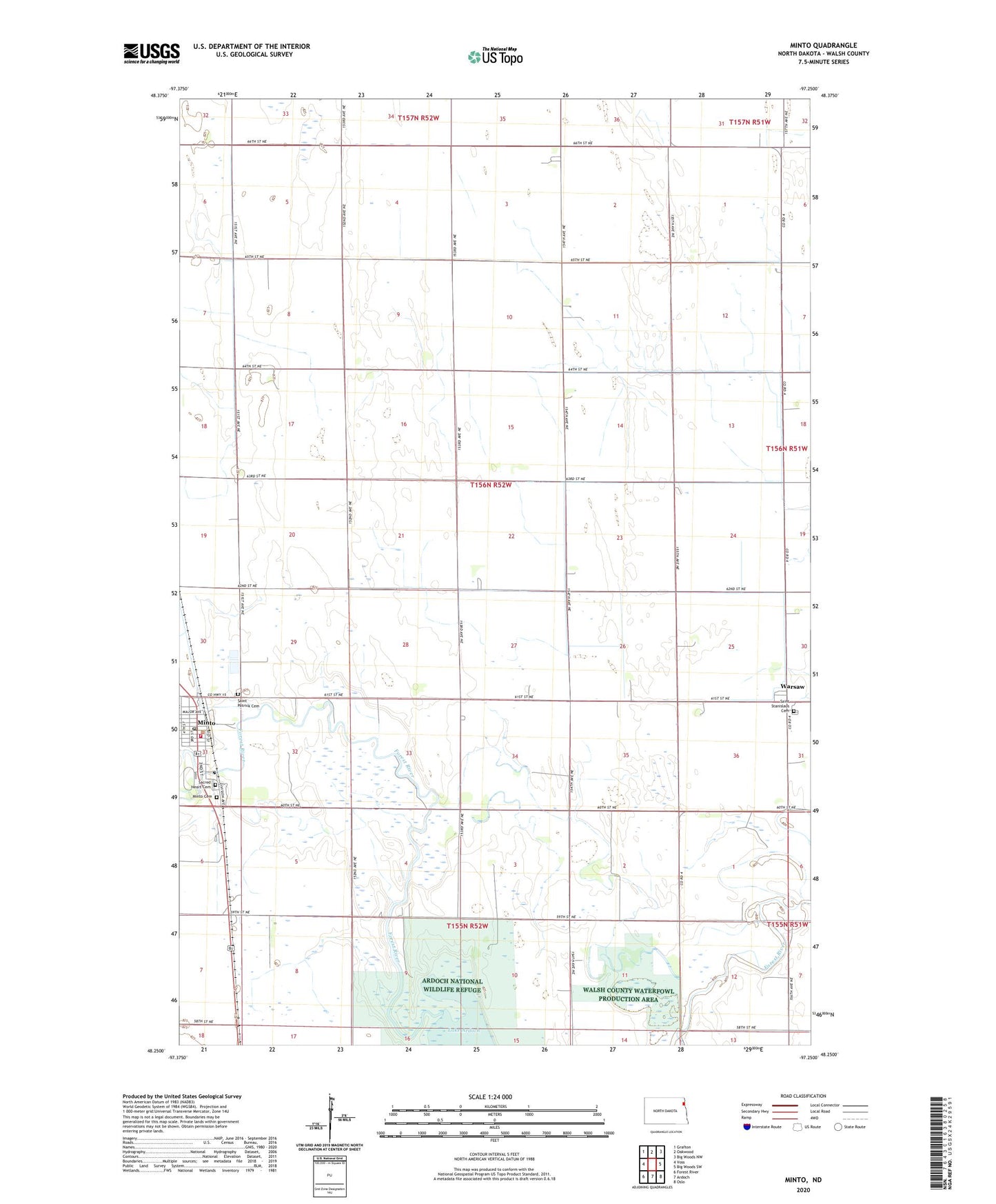
Minto North Dakota US Topo Map
Couldn't load pickup availability
2024 topographic map quadrangle Minto in the state of North Dakota. Scale: 1:24000. Based on the newly updated USGS 7.5' US Topo map series, this map is in the following counties: Walsh. The map contains contour data, water features, and other items you are used to seeing on USGS maps, but also has updated roads and other features. This is the next generation of topographic maps. Printed on high-quality waterproof paper with UV fade-resistant inks.
Quads adjacent to this one:
West: Voss
Northwest: Grafton
North: Oakwood
Northeast: Big Woods NW
East: Big Woods SW
South: Ardoch
Southwest: Forest River
This map covers the same area as the classic USGS quad with code o48097c3.
Contains the following named places: City of Minto, Minto, Minto Cemetery, Minto City Hall, Minto Community Center, Minto Fire Department, Minto Post Office, Sacred Heart Cemetery, Saint Patrick Cemetery, Saint Stanislaus Cemetery, Township of Harriston, Walsh County Historical Museum, Walsh County Waterfowl Production Area, Warsaw