MyTopo
Bowman North Dakota US Topo Map
Couldn't load pickup availability
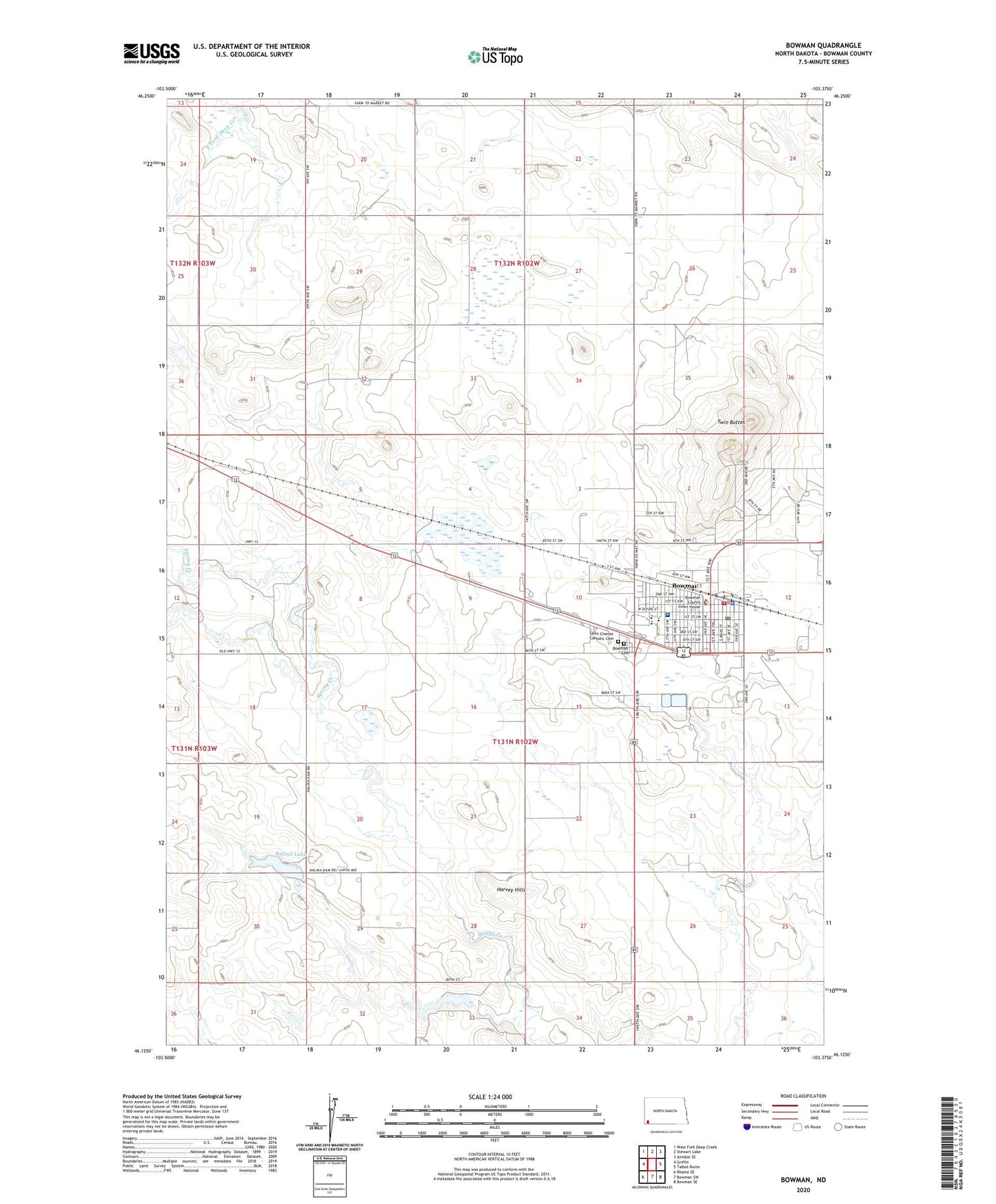
2024 topographic map quadrangle Bowman in the state of North Dakota. Scale: 1:24000. Based on the newly updated USGS 7.5' US Topo map series, this map is in the following counties: Bowman. The map contains contour data, water features, and other items you are used to seeing on USGS maps, but also has updated roads and other features. This is the next generation of topographic maps. Printed on high-quality waterproof paper with UV fade-resistant inks.
Quads adjacent to this one:
West: Griffin
Northwest: West Fork Deep Creek
North: Stewart Lake
Northeast: Amidon SE
East: Talbot Butte
Southeast: Bowman SE
South: Bowman SW
Southwest: Rhame SE
This map covers the same area as the classic USGS quad with code o46103b4.
Contains the following named places: Bowman, Bowman Cemetery, Bowman City Hall, Bowman County Courthouse, Bowman County Public School, Bowman County Sheriff's Office, Bowman Fire Department, Bowman Municipal Airport, Bowman Police Department, Bowman Post Office, Bowman Regional Public Library, City of Bowman, Harvey Hills, Kalina Dam, Kalina Lake, Miller Field, Pioneer Trails Regional Museum, Saint Charles Catholic Cemetery, Southwest Health Care Services-Long Term Care Center, Southwest Healthcare Service Hospital, Star School, Township of Bowman, Township of Star, Twin Buttes, ZIP Code: 58623