MyTopo
Amidon SE North Dakota US Topo Map
Couldn't load pickup availability
Also explore the Amidon SE Forest Service Topo of this same quad for updated USFS data
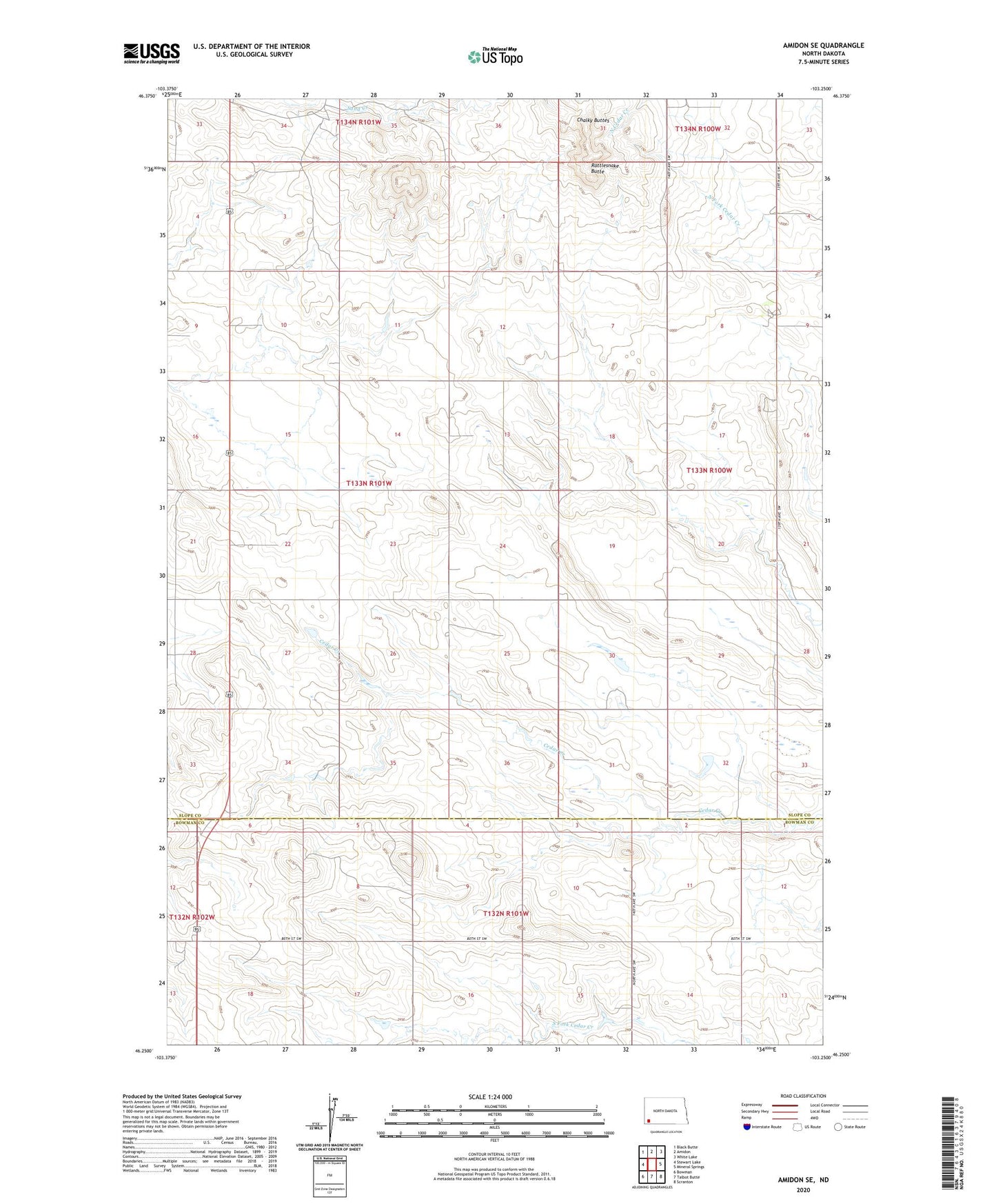
2024 topographic map quadrangle Amidon SE in the state of North Dakota. Scale: 1:24000. Based on the newly updated USGS 7.5' US Topo map series, this map is in the following counties: Slope, Bowman. The map contains contour data, water features, and other items you are used to seeing on USGS maps, but also has updated roads and other features. This is the next generation of topographic maps. Printed on high-quality waterproof paper with UV fade-resistant inks.
Quads adjacent to this one:
West: Stewart Lake
Northwest: Black Butte
North: Amidon
Northeast: White Lake
East: Mineral Springs
Southeast: Scranton
South: Talbot Butte
Southwest: Bowman
This map covers the same area as the classic USGS quad with code o46103c3.
Contains the following named places: Rattlesnake Butte, Township of Sheets