MyTopo
Brinsmade SW North Dakota US Topo Map
Couldn't load pickup availability
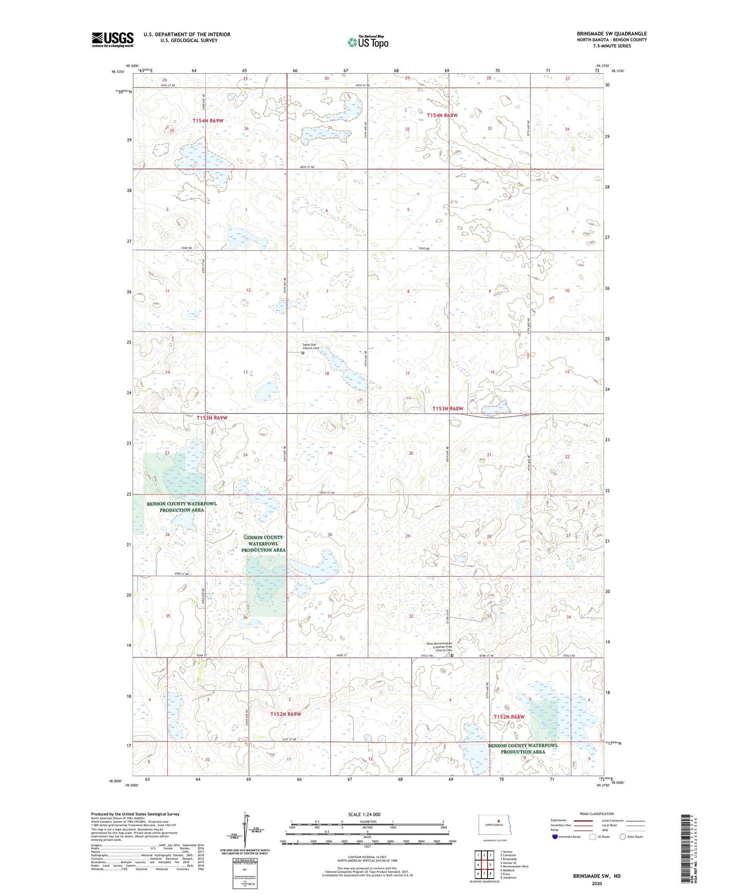
2024 topographic map quadrangle Brinsmade SW in the state of North Dakota. Scale: 1:24000. Based on the newly updated USGS 7.5' US Topo map series, this map is in the following counties: Benson. The map contains contour data, water features, and other items you are used to seeing on USGS maps, but also has updated roads and other features. This is the next generation of topographic maps. Printed on high-quality waterproof paper with UV fade-resistant inks.
Quads adjacent to this one:
West: Harlow SE
Northwest: Harlow
North: Comstock
Northeast: Brinsmade
East: Minnewaukan West
Southeast: Josephine
South: Flora
Southwest: Maddock
This map covers the same area as the classic USGS quad with code o48099a4.
Contains the following named places: Eldon School, Saint Olaf Church, Saint Olaf Church Cemetery, Township of Eldon, West Minnewaukan Church, West Minnewaukan Lutheran Free Church Cemetery