MyTopo
Maddock North Dakota US Topo Map
Couldn't load pickup availability
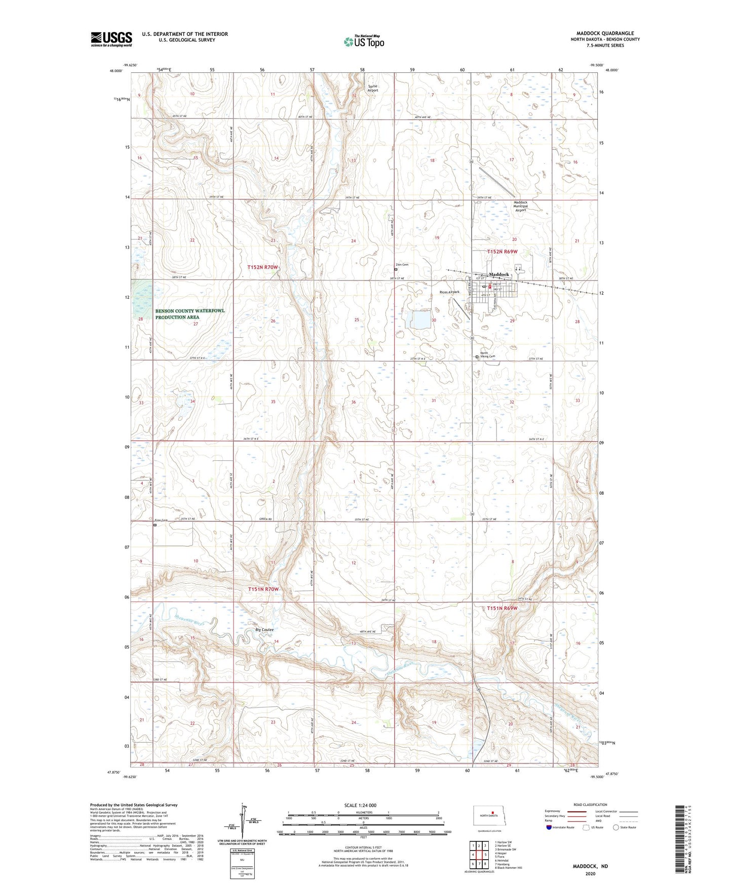
2024 topographic map quadrangle Maddock in the state of North Dakota. Scale: 1:24000. Based on the newly updated USGS 7.5' US Topo map series, this map is in the following counties: Benson. The map contains contour data, water features, and other items you are used to seeing on USGS maps, but also has updated roads and other features. This is the next generation of topographic maps. Printed on high-quality waterproof paper with UV fade-resistant inks.
Quads adjacent to this one:
West: Hesper
Northwest: Harlow SW
North: Harlow SE
Northeast: Brinsmade SW
East: Flora
Southeast: Black Hammer Hill
South: Hamberg
Southwest: Heimdal
This map covers the same area as the classic USGS quad with code o47099h5.
Contains the following named places: Arne School, Big Coulee, City of Maddock, Fron Cemetery, Fron Church, Maddock, Maddock Ambulance Service, Maddock City Hall, Maddock Community Center, Maddock Community Library, Maddock Fire Department, Maddock Municipal Airport, Maddock Post Office, Maddock Public School, North Viking Cemetery, Quarve School, Rices Airpark, Township of Arne, Township of Hesper, Zion Cemetery, ZIP Code: 58348