MyTopo
Burlington NE North Dakota US Topo Map
Couldn't load pickup availability
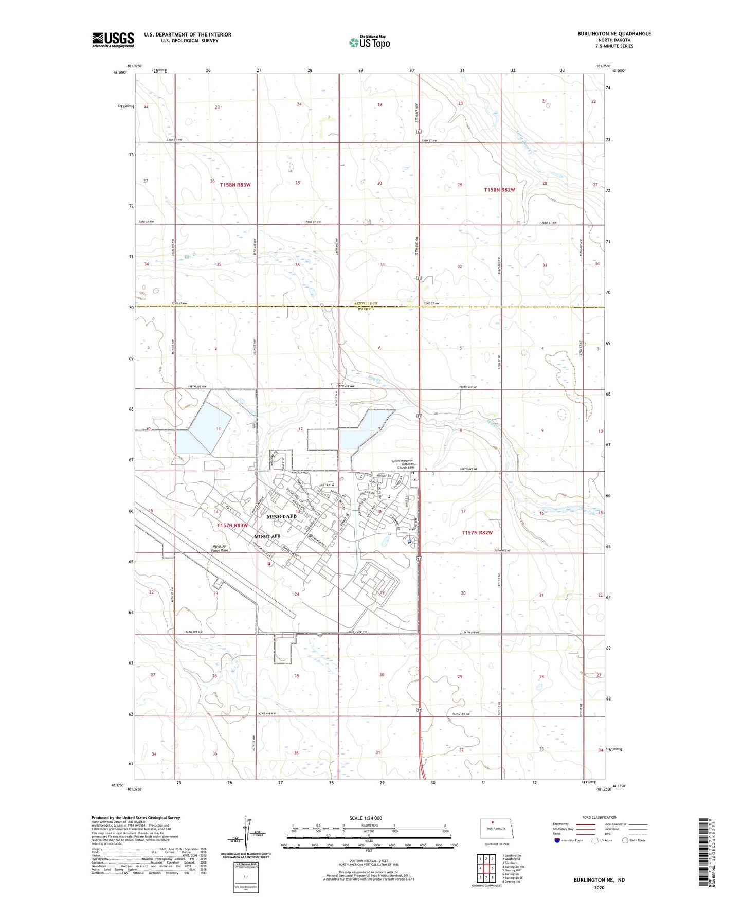
2024 topographic map quadrangle Burlington NE in the state of North Dakota. Scale: 1:24000. Based on the newly updated USGS 7.5' US Topo map series, this map is in the following counties: Ward, Renville. The map contains contour data, water features, and other items you are used to seeing on USGS maps, but also has updated roads and other features. This is the next generation of topographic maps. Printed on high-quality waterproof paper with UV fade-resistant inks.
Quads adjacent to this one:
West: Burlington NW
Northwest: Lansford SW
North: Lansford SE
Northeast: Glenburn
East: Deering NW
Southeast: Deering SW
South: Burlington SE
Southwest: Burlington
This map covers the same area as the classic USGS quad with code o48101d3.
Contains the following named places: Copeland School Number 1, Dakota Elementary School, Department of Defense 5th Medical Group Ambulance Service, Lynch Church, Lynch Immanuel Lutheran Church Cemetery, Memorial Middle School, Minot Air Force Base, Minot Air Force Base Census Designated Place, Minot Air Force Base Fire Department, Minot Air Force Base Library, Minot Airforce Base Post Office, Montessori of Minot School, North Plains Elementary School, Rough Rider Golf Course, School Number 2, School Number 3, School Number 4, Township of Tatman, United States Air Force Regional Hospital, ZIP Codes: 58704, 58705