MyTopo
Carpenter Lake North Dakota US Topo Map
Couldn't load pickup availability
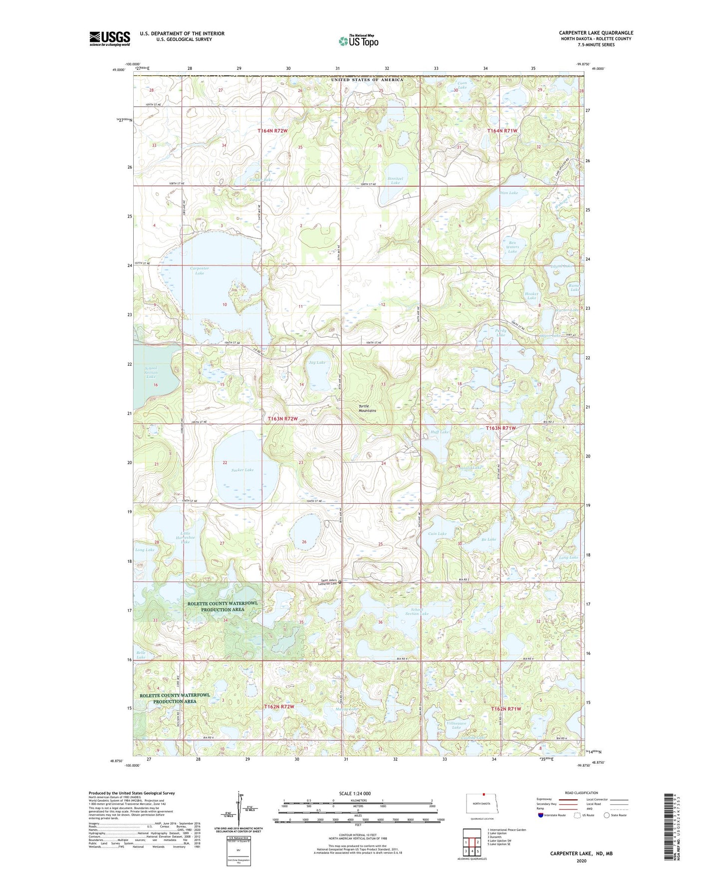
2020 topographic map quadrangle Carpenter Lake in the state of North Dakota. Scale: 1:24000. Based on the newly updated USGS 7.5' US Topo map series, this map is in the following counties: Rolette. The map contains contour data, water features, and other items you are used to seeing on USGS maps, but also has updated roads and other features. This is the next generation of topographic maps. Printed on high-quality waterproof paper with UV fade-resistant inks.
Quads adjacent to this one:
West: International Peace Garden
East: Lake Upsilon
Southeast: Lake Upsilon SE
South: Lake Upsilon SW
Southwest: Dunseith
Contains the following named places: Belle Lake, Ben Waters Lake, Bu Lake, Cain Lake, Carpenter Lake, Cassidy Lake, Coon Lake, Dion Lake, Donald Lake, Gravel Bottom Lake, Hooker Lake, Horseshoe Lake, Huff Lake, Island Lake, Jay Lake, Little Horseshoe Lake, Long Lake, Magog Lake, Olson Lake, Purdy Lake, Rolette County Waterfowl Production Area, Saint John's Lutheran Cemetery, School Section Lake, School Section Lake National Wildlife Refuge, Streitzel Lake, Sucker Lake, Unorganized Territory of North Rolette, Villneauve Lake, Wakopa Dam, Wakopa State Game Management Area, Warner Lake, Wendland Lake, Ziegler Lake