MyTopo
International Peace Garden North Dakota US Topo Map
Couldn't load pickup availability
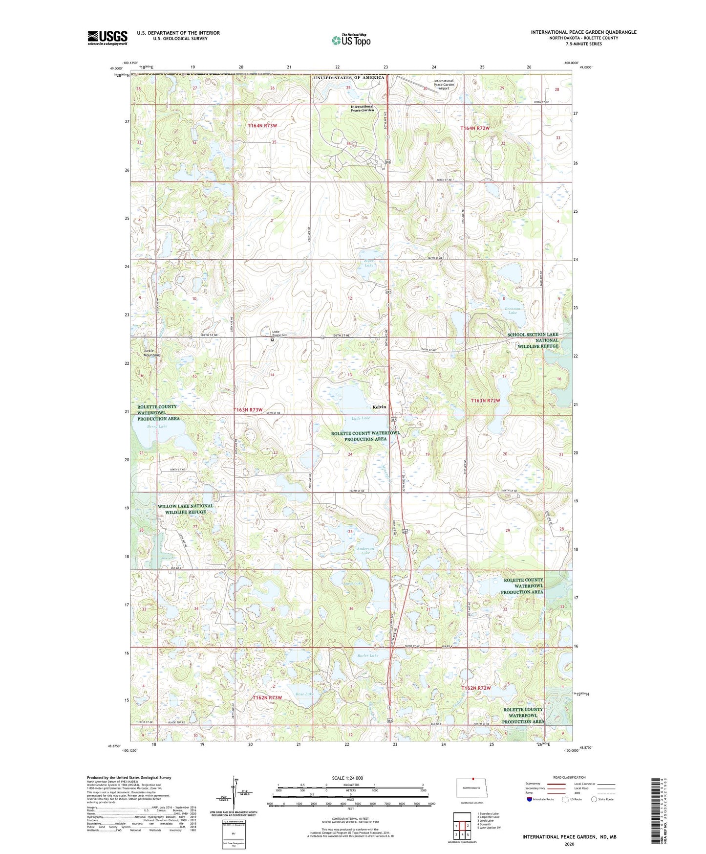
2024 topographic map quadrangle International Peace Garden in the state of North Dakota. Scale: 1:24000. Based on the newly updated USGS 7.5' US Topo map series, this map is in the following counties: Rolette. The map contains contour data, water features, and other items you are used to seeing on USGS maps, but also has updated roads and other features. This is the next generation of topographic maps. Printed on high-quality waterproof paper with UV fade-resistant inks.
Quads adjacent to this one:
West: Boundary Lake
East: Carpenter Lake
Southeast: Lake Upsilon SW
South: Dunseith
Southwest: Lords Lake
This map covers the same area as the classic USGS quad with code o48100h1.
Contains the following named places: Anderson Lake, Berry Lake, Brennan Lake, Butler Lake, Eldridge Lake, International Peace Garden, International Peace Garden Airport, Jones Lake, Kelvin, Little Prairie, Little Prairie Cemetery, Little Prairie Church, Lockhart Lake, Long Lake, Lyde Lake, Myer Lake, Rabbit City Lake, Rose Lake, Schmidt Lake, Turtle Mountains