MyTopo
Dunseith North Dakota US Topo Map
Couldn't load pickup availability
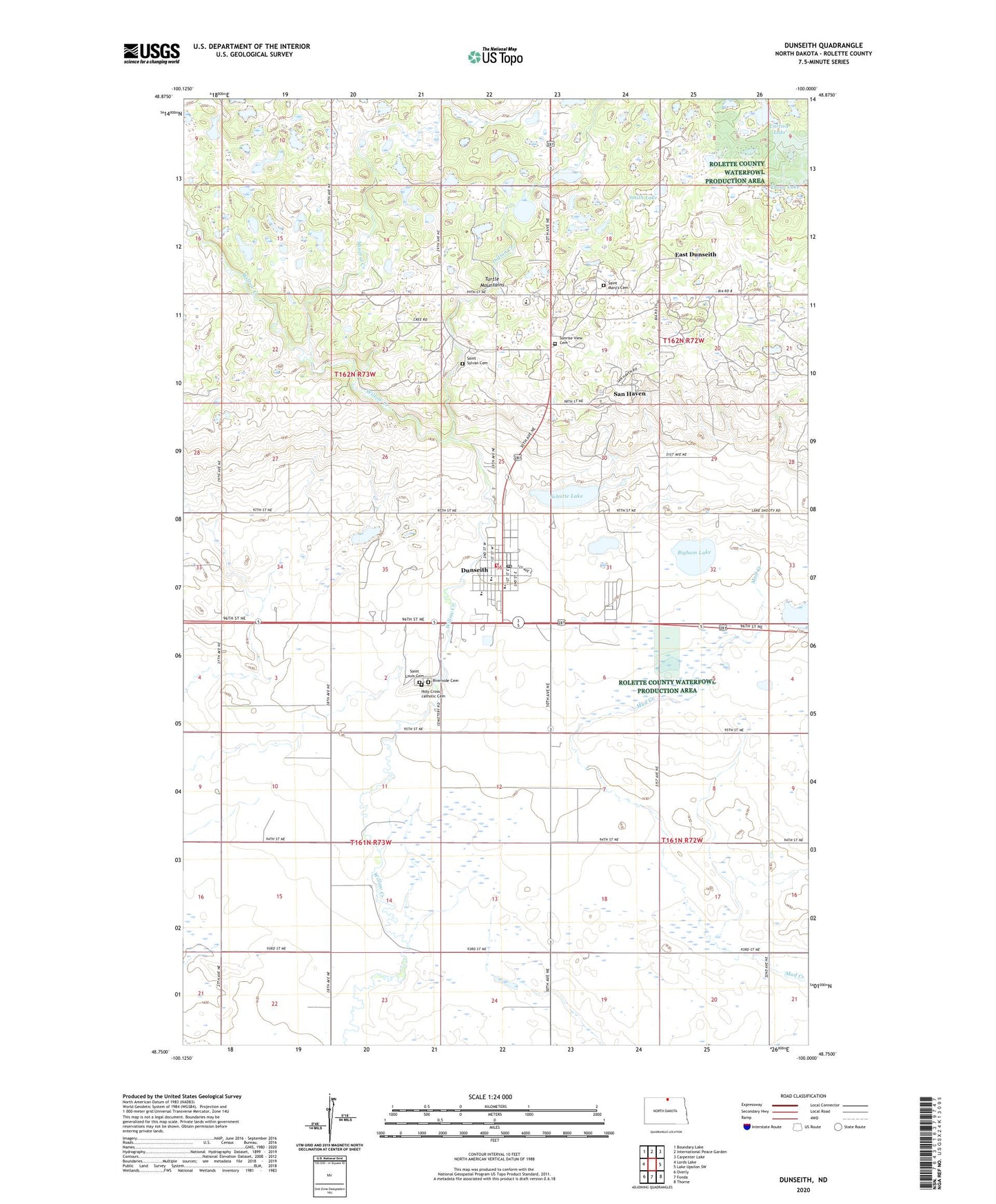
2024 topographic map quadrangle Dunseith in the state of North Dakota. Scale: 1:24000. Based on the newly updated USGS 7.5' US Topo map series, this map is in the following counties: Rolette. The map contains contour data, water features, and other items you are used to seeing on USGS maps, but also has updated roads and other features. This is the next generation of topographic maps. Printed on high-quality waterproof paper with UV fade-resistant inks.
Quads adjacent to this one:
West: Lords Lake
Northwest: Boundary Lake
North: International Peace Garden
Northeast: Carpenter Lake
East: Lake Upsilon SW
Southeast: Thorne
South: Fonda
Southwest: Overly
This map covers the same area as the classic USGS quad with code o48100g1.
Contains the following named places: Bigham Lake, Carlisle Lake, City of Dunseith, Currie School, Dunseith, Dunseith City Hall, Dunseith Community Nursing Home, Dunseith Day Elementary School, Dunseith Elementary School, Dunseith Fire Department, Dunseith High School, Dunseith Landing Field, Dunseith Post Office, East Dunseith, East Dunseith Census Designated Place, Holy Cross catholic Cemetery, Indian Creek, Log House Information Center, Mineral Creek, Riverside Cemetery, Saint Louis Cemetery, Saint Mary's Cemetery, Saint Marys Mission, Saint Sylvan Cemetery, Saint Sylvan Mission, San Haven, Schutte Lake, Smith Lake, Sunrise View Cemetery, Thorn Lake, Township of Russell, Wee'l Turtle Statue, ZIP Code: 58329