MyTopo
Lake Upsilon SE North Dakota US Topo Map
Couldn't load pickup availability
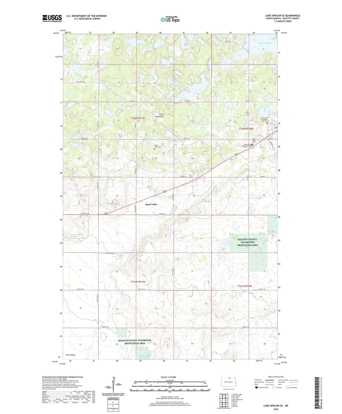
2024 topographic map quadrangle Lake Upsilon SE in the state of North Dakota. Scale: 1:24000. Based on the newly updated USGS 7.5' US Topo map series, this map is in the following counties: Rolette. The map contains contour data, water features, and other items you are used to seeing on USGS maps, but also has updated roads and other features. This is the next generation of topographic maps. Printed on high-quality waterproof paper with UV fade-resistant inks.
Quads adjacent to this one:
West: Lake Upsilon SW
Northwest: Carpenter Lake
North: Lake Upsilon
Northeast: Saint John
East: Belcourt
Southeast: Mylo NW
South: Rolette
Southwest: Thorne
This map covers the same area as the classic USGS quad with code o48099g7.
Contains the following named places: Belcourt Post Office, KEYA-FM (Belcourt), Marion Lakes, Ojibwa Indian School, Queen of Peace Priory, Rolette County, Saint Ann Catholic Original Cemetery, Saint Anns Addition Cemetery, Saint Anns Cemetery, Saint Anns Indian Mission, Saint Pauls Church, Shell Valley, Shell Valley Census Designated Place, Sky Dancer Casino and Resort, Tiny Turtles Preschool, Township of Shell Valley, Turtle Mountain Reservation, Unorganized Territory of Turtle Mountain, White Stone Cemetery, ZIP Code: 58316