
MyTopo
Casselton North Dakota US Topo Map
Couldn't load pickup availability
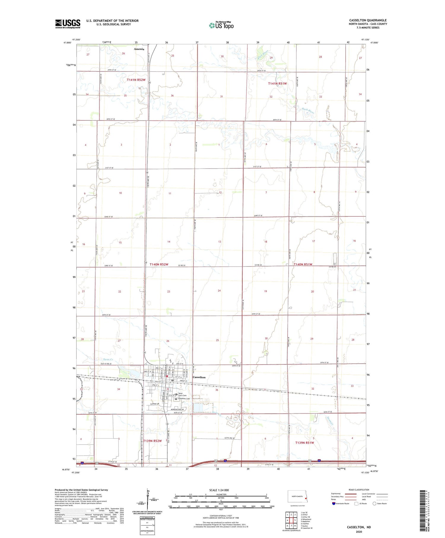
2020 topographic map quadrangle Casselton in the state of North Dakota. Scale: 1:24000. Based on the newly updated USGS 7.5' US Topo map series, this map is in the following counties: Cass. The map contains contour data, water features, and other items you are used to seeing on USGS maps, but also has updated roads and other features. This is the next generation of topographic maps. Printed on high-quality waterproof paper with UV fade-resistant inks.
Quads adjacent to this one:
West: Wheatland
Northwest: Ayr SE
North: Arthur
Northeast: Arthur SE
East: Mapleton
Southeast: Casselton SE
South: Durbin
Southwest: Chaffee
Contains the following named places: Cass County, Casselton, Casselton Ambulance Service, Casselton Cemetery, Casselton City Hall, Casselton Fire Department, Casselton Post Office, Casselton Public Library, Casselton United Methodist Church, Central Cass Public School, City of Casselton, Cottonwood Golf Club, Dalrymple Spur, Ellison Public School, Martin's American Lutheran Church, Saint Leo's Cemetery, Saint Leo's Parish House, Saint Leo's Roman Catholic Church, Township of Casselton, Westminister Presbyterian Church, Woell Mansion Museum, ZIP Code: 58012


