MyTopo
Charlson SW North Dakota US Topo Map
Couldn't load pickup availability
Also explore the Charlson SW Forest Service Topo of this same quad for updated USFS data
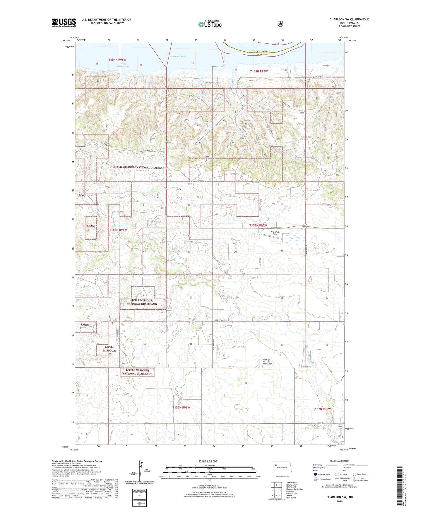
2024 topographic map quadrangle Charlson SW in the state of North Dakota. Scale: 1:24000. Based on the newly updated USGS 7.5' US Topo map series, this map is in the following counties: McKenzie, Williams. The map contains contour data, water features, and other items you are used to seeing on USGS maps, but also has updated roads and other features. This is the next generation of topographic maps. Printed on high-quality waterproof paper with UV fade-resistant inks.
Quads adjacent to this one:
West: Tobacco Garden Bay
Northwest: Red Mike Hill
North: Charlson NW
Northeast: Charlson NE
East: Charlson
Southeast: Blue Buttes
South: Keene
Southwest: Demicks Lake
This map covers the same area as the classic USGS quad with code o48102a8.
Contains the following named places: Charlson Oil Field, E Norby Ranch, Good Hope Cemetery - First Lutheran Cemetery, Good Hope Church, I Thompson Ranch, L Swenson Ranch, L Wisness Ranch, Olson Private Airstrip, Prop Wash Field, R Norby Ranch, Swanson Ranch, Thompson Ranch, Thompson Ranches, Township of Elm Tree