MyTopo
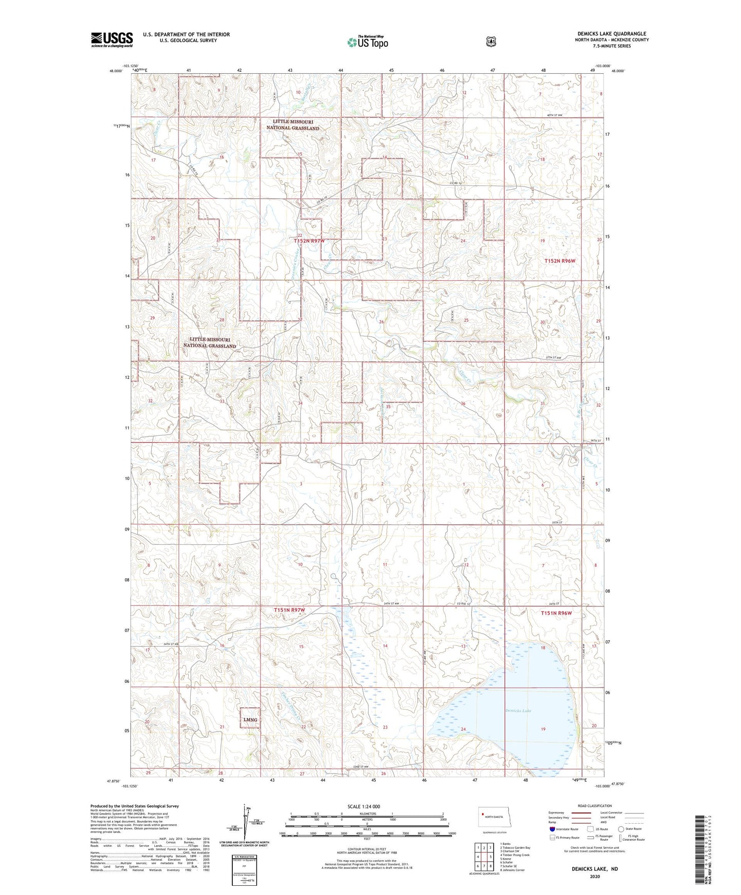
Demicks Lake North Dakota US Topo Map
Couldn't load pickup availability
Also explore the Demicks Lake Forest Service Topo of this same quad for updated USFS data
2024 topographic map quadrangle Demicks Lake in the state of North Dakota. Scale: 1:24000. Based on the newly updated USGS 7.5' US Topo map series, this map is in the following counties: McKenzie. The map contains contour data, water features, and other items you are used to seeing on USGS maps, but also has updated roads and other features. This is the next generation of topographic maps. Printed on high-quality waterproof paper with UV fade-resistant inks.
Quads adjacent to this one:
West: Timber Prong Creek
Northwest: Banks
North: Tobacco Garden Bay
Northeast: Charlson SW
East: Keene
Southeast: Johnsons Corner
South: Schafer SE
Southwest: Schafer
This map covers the same area as the classic USGS quad with code o47103h1.
Contains the following named places: Bartall Creek, D Sivertson Ranch, Demicks Lake, Greenieu Coulee, H Stole Ranch, J Wahus Ranch, Jackson Coulee, M Wahus Ranch, North Branch Clear Creek, R Wahus Ranch, S Grantier Ranch