MyTopo
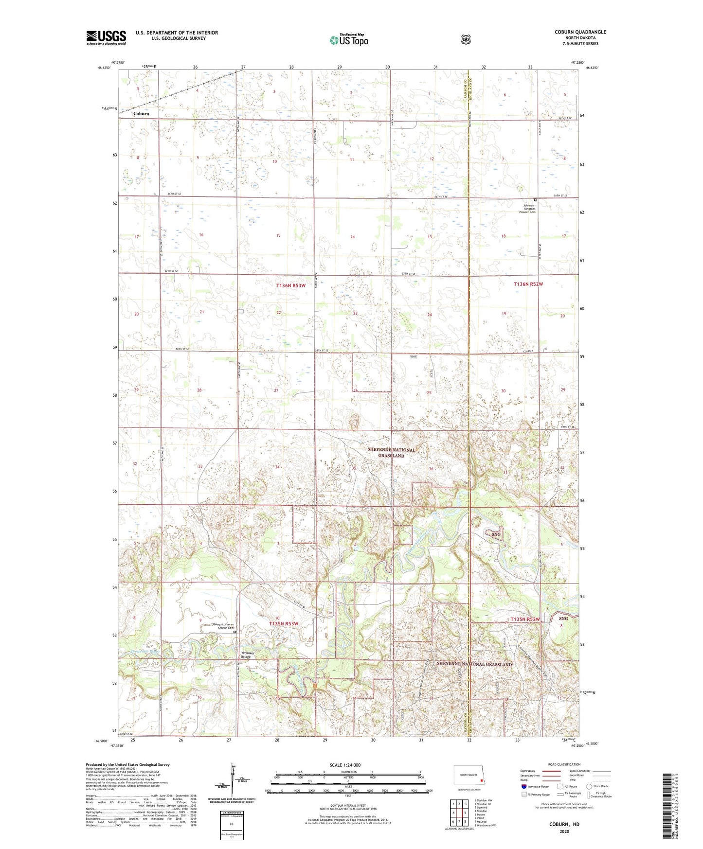
Coburn North Dakota US Topo Map
Couldn't load pickup availability
Also explore the Coburn Forest Service Topo of this same quad for updated USFS data
2024 topographic map quadrangle Coburn in the state of North Dakota. Scale: 1:24000. Based on the newly updated USGS 7.5' US Topo map series, this map is in the following counties: Ransom, Richland. The map contains contour data, water features, and other items you are used to seeing on USGS maps, but also has updated roads and other features. This is the next generation of topographic maps. Printed on high-quality waterproof paper with UV fade-resistant inks.
Quads adjacent to this one:
West: Sheldon
Northwest: Sheldon NW
North: Sheldon NE
Northeast: Leonard
East: Power
Southeast: Wyndmere NW
South: McLeod
Southwest: Venlo
This map covers the same area as the classic USGS quad with code o46097e3.
Contains the following named places: Coburn, Coburn Town Hall, Johnson - Vangsnes Pioneer Cemetery, Owego, Owego Church, Owego Lutheran Church Cemetery, Township of Coburn, Ylvisaker Bridge