MyTopo
Leonard North Dakota US Topo Map
Couldn't load pickup availability
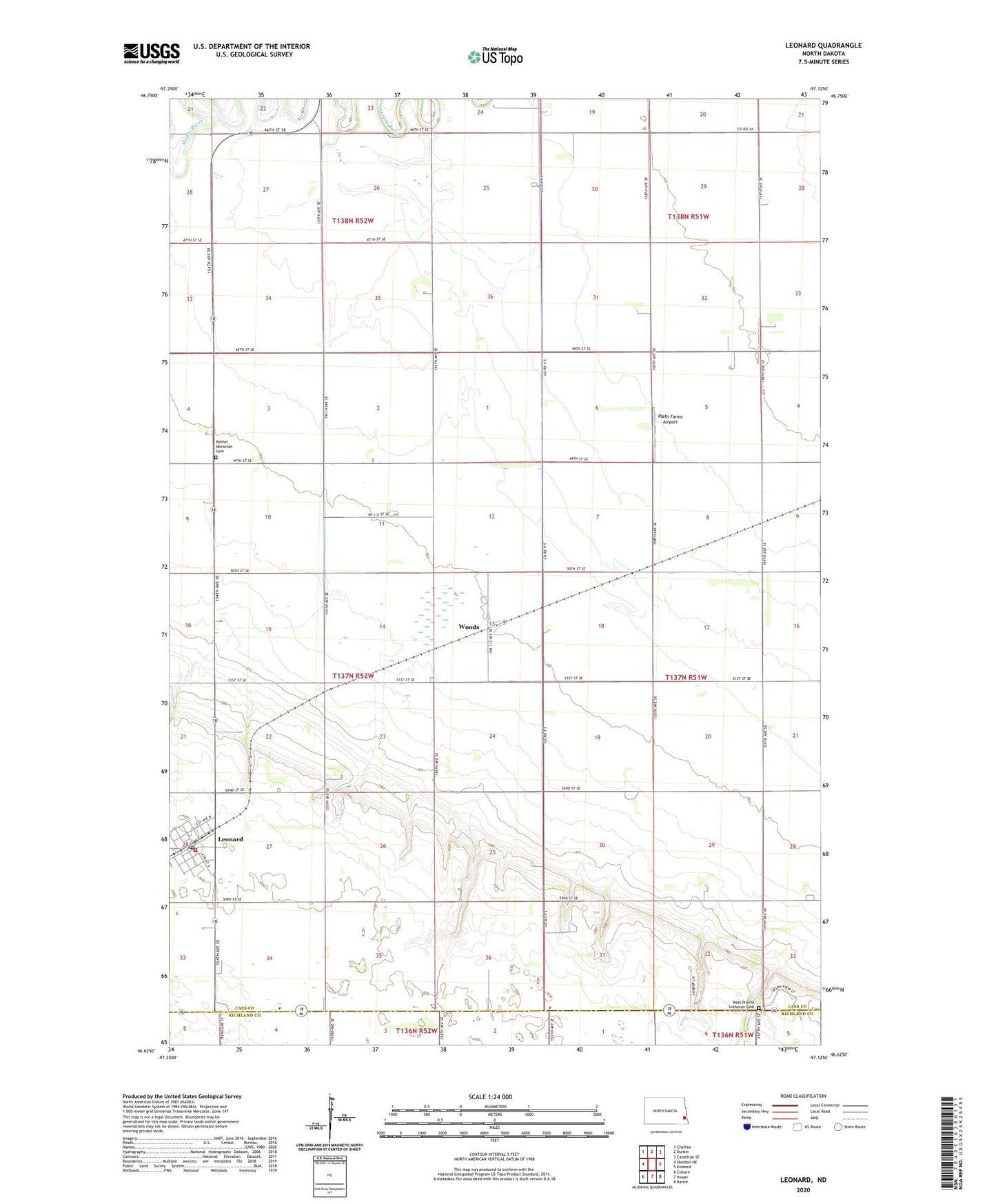
2024 topographic map quadrangle Leonard in the state of North Dakota. Scale: 1:24000. Based on the newly updated USGS 7.5' US Topo map series, this map is in the following counties: Cass, Richland. The map contains contour data, water features, and other items you are used to seeing on USGS maps, but also has updated roads and other features. This is the next generation of topographic maps. Printed on high-quality waterproof paper with UV fade-resistant inks.
Quads adjacent to this one:
West: Sheldon NE
Northwest: Chaffee
North: Durbin
Northeast: Casselton SE
East: Kindred
Southeast: Barrie
South: Power
Southwest: Coburn
This map covers the same area as the classic USGS quad with code o46097f2.
Contains the following named places: Andvik Landing Strip, Bethel Church, Bethel Moravian Cemetery, City of Leonard, Leonard, Leonard Festival Hall, Leonard Fire Department, Leonard Post Office, Plath Farms Airport, Township of Leonard, Watts Free Library, West Prairie Church, West Prairie Lutheran Cemetery, Woods