MyTopo
Crete North Dakota US Topo Map
Couldn't load pickup availability
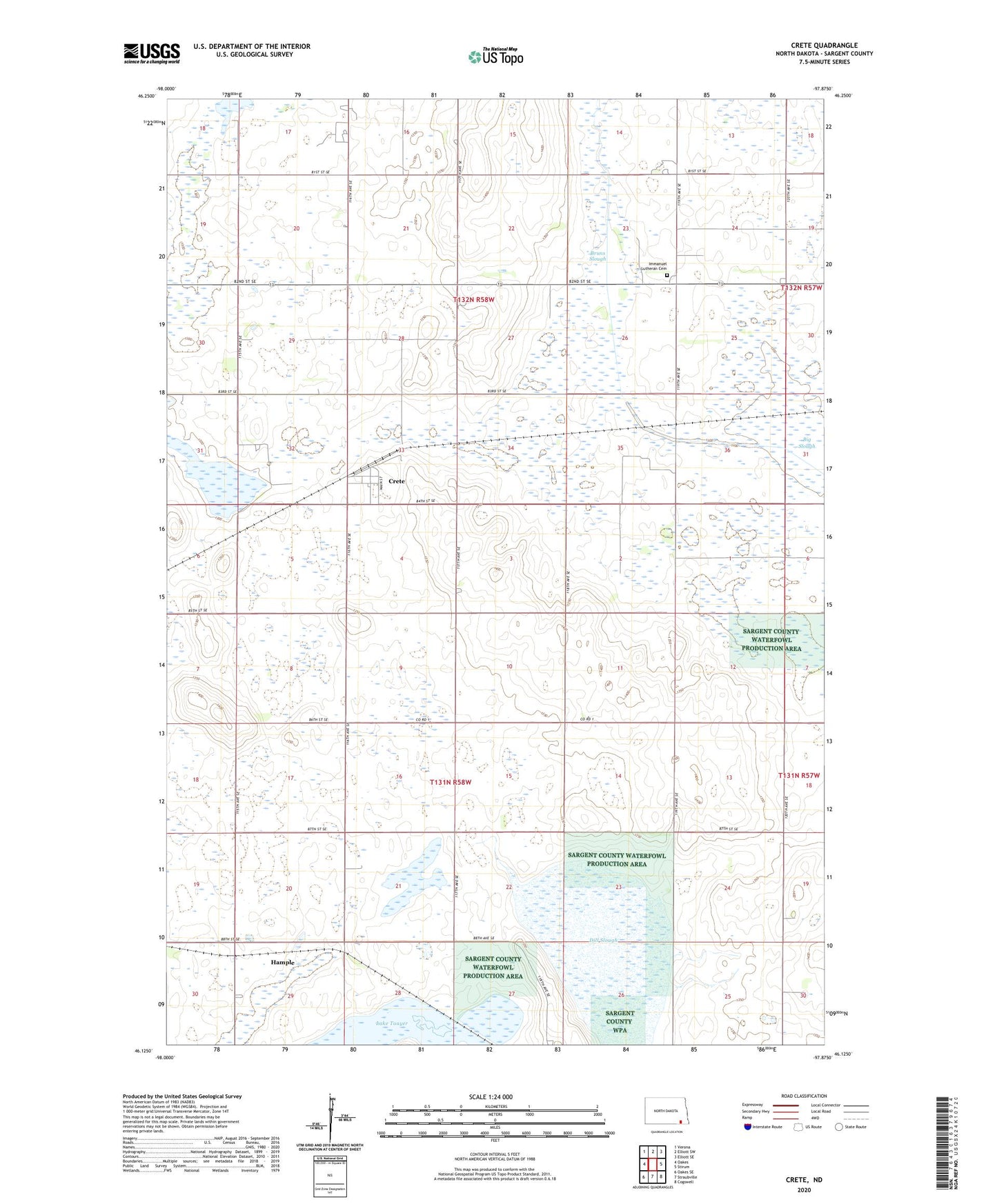
2024 topographic map quadrangle Crete in the state of North Dakota. Scale: 1:24000. Based on the newly updated USGS 7.5' US Topo map series, this map is in the following counties: Sargent. The map contains contour data, water features, and other items you are used to seeing on USGS maps, but also has updated roads and other features. This is the next generation of topographic maps. Printed on high-quality waterproof paper with UV fade-resistant inks.
Quads adjacent to this one:
West: Oakes
Northwest: Verona
North: Elliott SW
Northeast: Elliott SE
East: Stirum
Southeast: Cogswell
South: Straubville
Southwest: Oakes SE
This map covers the same area as the classic USGS quad with code o46097b8.
Contains the following named places: Big Slough, Bruns Slough, Crete, Denver School, Dill Slough, Emmanuel Church, Hample, Immanuel Lutheran Cemetery, Lake Schimmer, School Number 1, School Number 2, School Number 5, Township of Denver, Township of Verner