MyTopo
Oakes North Dakota US Topo Map
Couldn't load pickup availability
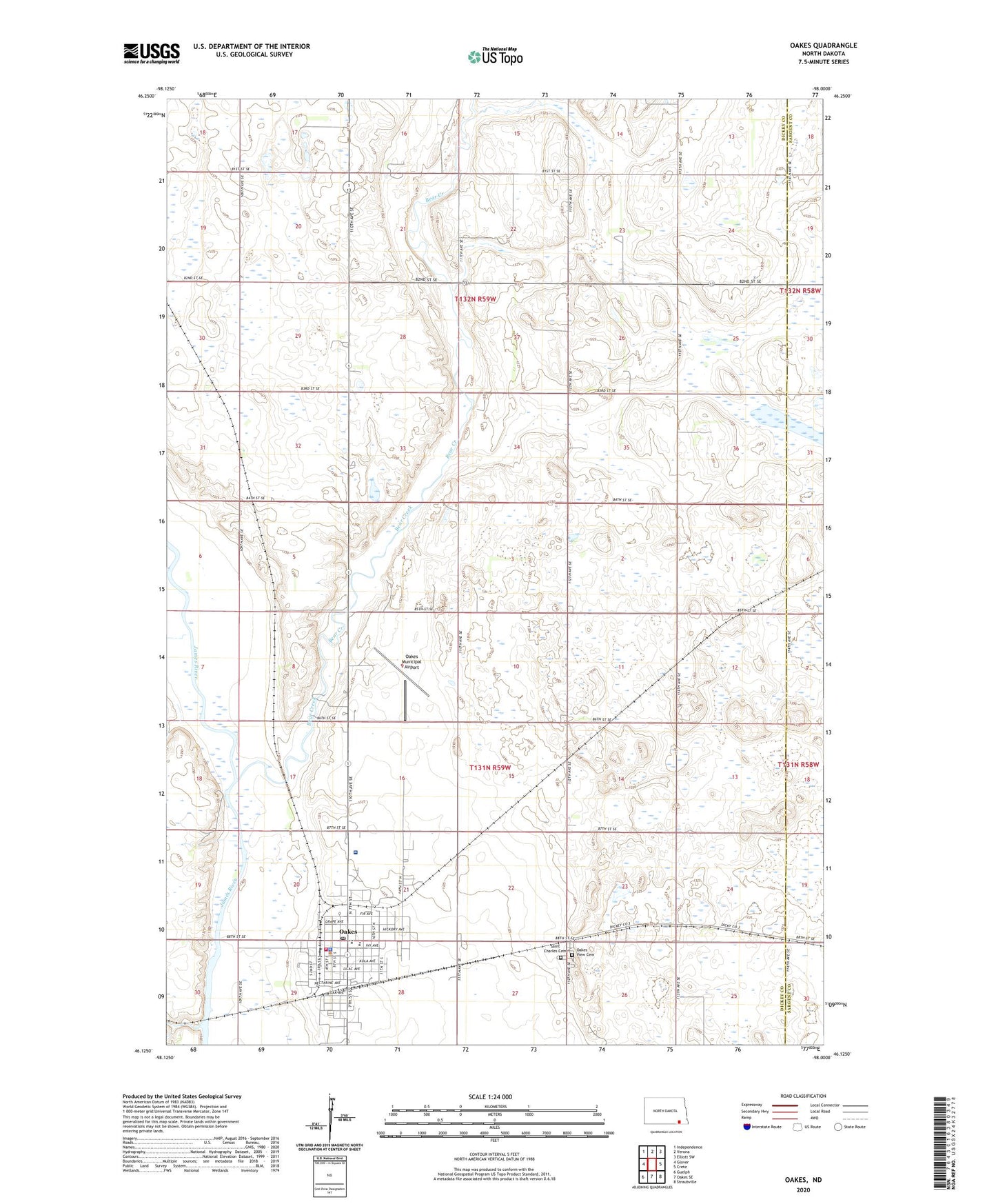
2024 topographic map quadrangle Oakes in the state of North Dakota. Scale: 1:24000. Based on the newly updated USGS 7.5' US Topo map series, this map is in the following counties: Dickey, Sargent. The map contains contour data, water features, and other items you are used to seeing on USGS maps, but also has updated roads and other features. This is the next generation of topographic maps. Printed on high-quality waterproof paper with UV fade-resistant inks.
Quads adjacent to this one:
West: Glover
Northwest: Independence
North: Verona
Northeast: Elliott SW
East: Crete
Southeast: Straubville
South: Oakes SE
Southwest: Guelph
This map covers the same area as the classic USGS quad with code o46098b1.
Contains the following named places: Bear Creek, CHI Oakes Hospital, City of Oakes, Clement Town Hall, Dickey County Heritage Center, Divide Town Hall, Good Samaritan Society-Oakes, Oakes, Oakes City Hall, Oakes City Police Department, Oakes Elementary School, Oakes Fire Station, Oakes Golf Club, Oakes High School, Oakes Municipal Airport, Oakes Post Office, Oakes School and Public Library, Oakes View Cemetery, Oakes Volunteer Ambulance Service, Saint Charles Cemetery, School Number 1, School Number 2, School Number 4, Township of Bear Creek, Township of Climax, Township of Divide