MyTopo
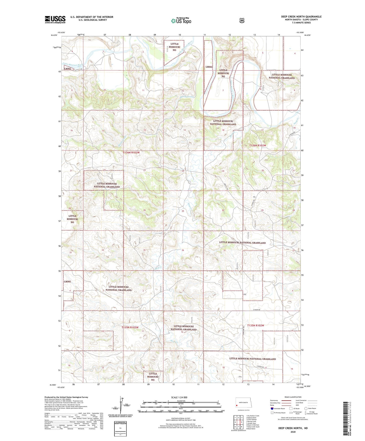
Deep Creek North North Dakota US Topo Map
Couldn't load pickup availability
Also explore the Deep Creek North Forest Service Topo of this same quad for updated USFS data
2024 topographic map quadrangle Deep Creek North in the state of North Dakota. Scale: 1:24000. Based on the newly updated USGS 7.5' US Topo map series, this map is in the following counties: Slope. The map contains contour data, water features, and other items you are used to seeing on USGS maps, but also has updated roads and other features. This is the next generation of topographic maps. Printed on high-quality waterproof paper with UV fade-resistant inks.
Quads adjacent to this one:
West: Spring Creek
Northwest: Dry Bullion Creek
North: Bullion Butte
Northeast: Cliffs Plateau
East: Juniper Spur
Southeast: Black Butte
South: Deep Creek South
Southwest: Boyce Creek East
This map covers the same area as the classic USGS quad with code o46103e5.
Contains the following named places: Bullion View School, Deep Creek, Jacobson Ranch, K Hafele Ranch, Logging Camp Ranch, Old Deep Creek Guard Station, Ponderosa Pine Area, Sand Creek, Spring Coulee, Unorganized Territory of Northwest Slope, Walser Crossing, Walser Ranch