MyTopo
Dengate North Dakota US Topo Map
Couldn't load pickup availability
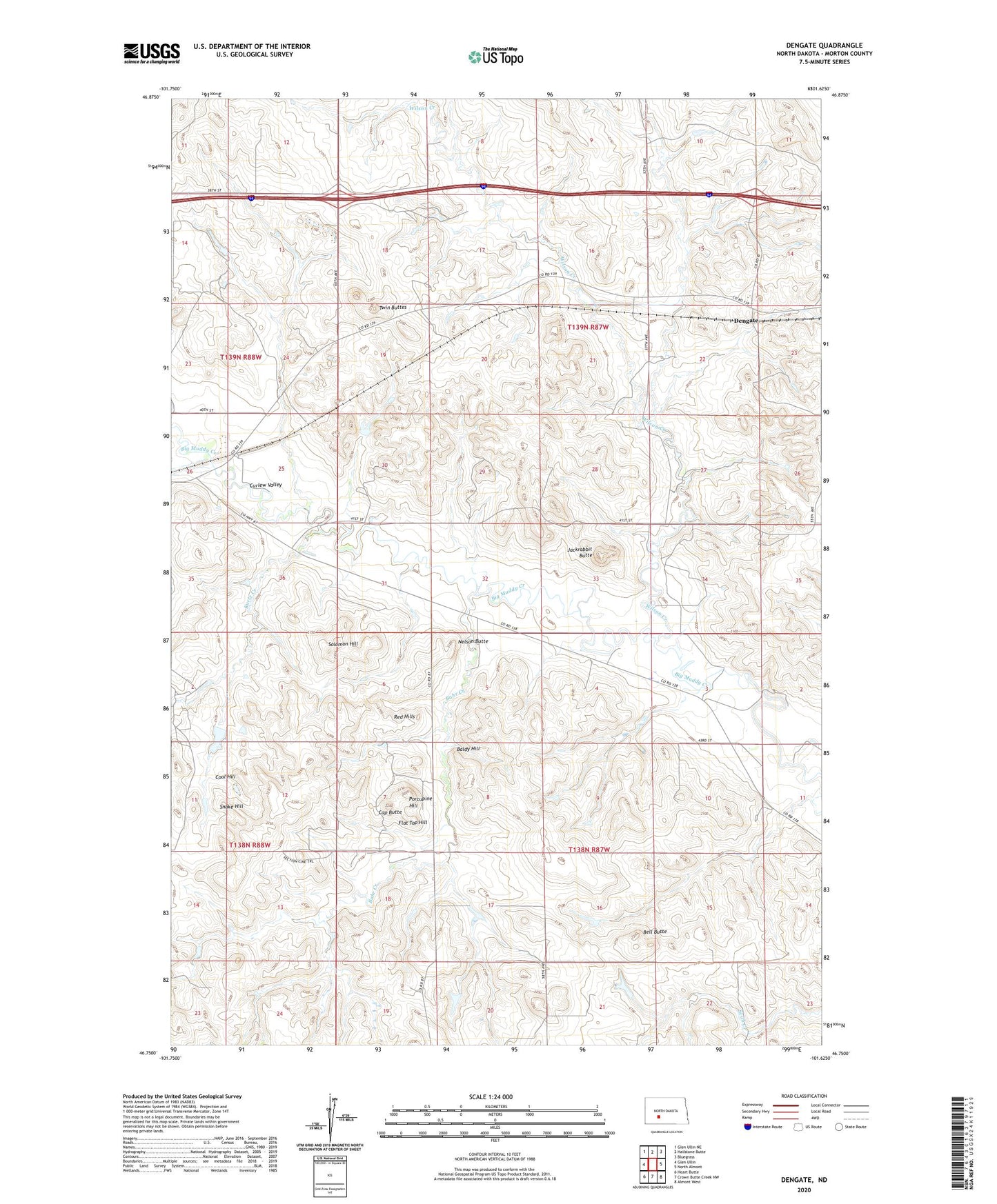
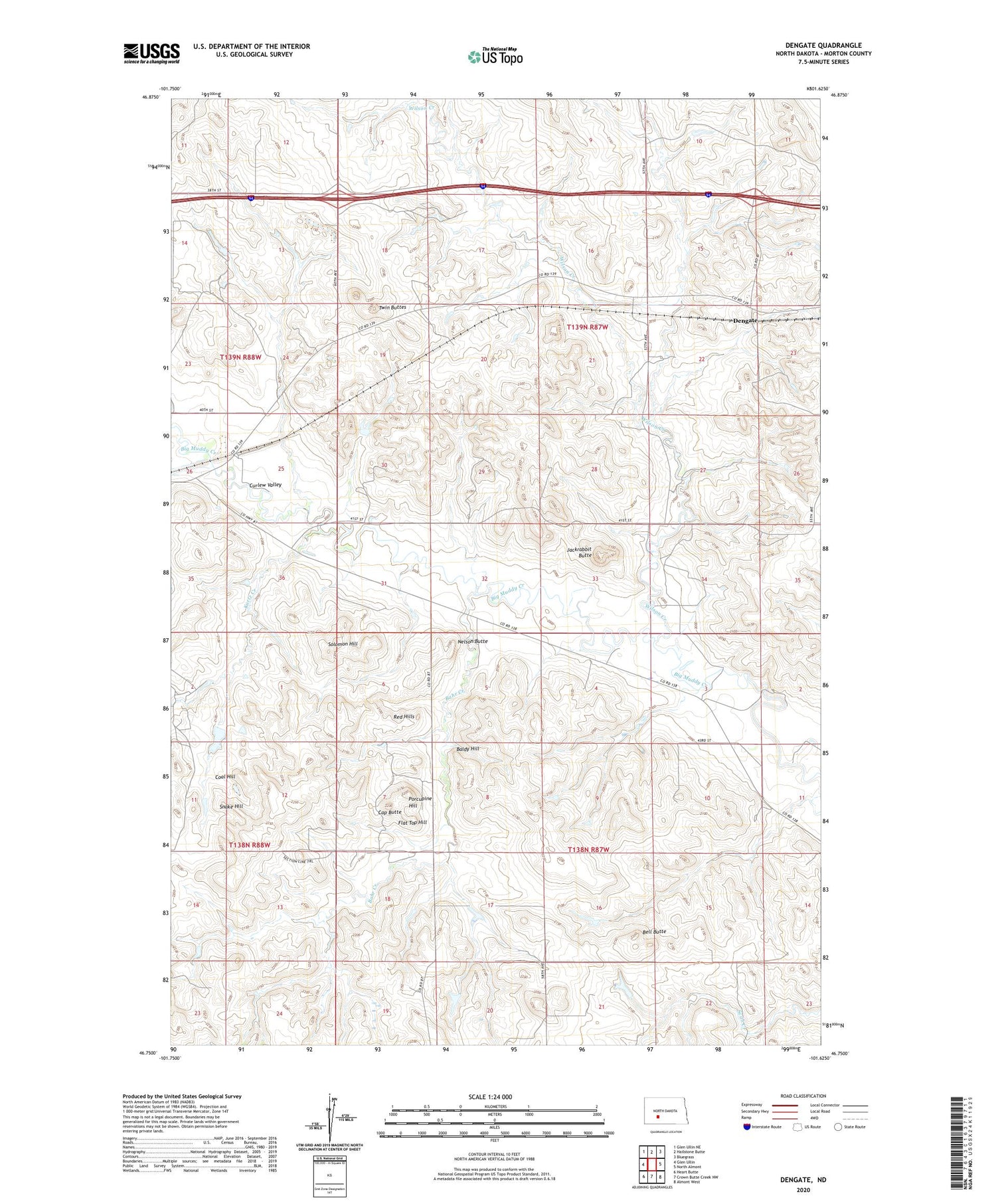
2020 topographic map quadrangle Dengate in the state of North Dakota. Scale: 1:24000. Based on the newly updated USGS 7.5' US Topo map series, this map is in the following counties: Morton. The map contains contour data, water features, and other items you are used to seeing on USGS maps, but also has updated roads and other features. This is the next generation of topographic maps. Printed on high-quality waterproof paper with UV fade-resistant inks.
Quads adjacent to this one:
West: Glen Ullin
Northwest: Glen Ullin NE
North: Hailstone Butte
Northeast: Bluegrass
East: North Almont
Southeast: Almont West
South: Crown Butte Creek NW
Southwest: Heart Butte
Contains the following named places: Bahr Creek, Baldy Hill, Bell Butte, Cap Butte, Coal Hill, Dengate, Flat Top Hill, Jackrabbit Butte, Kurtz Creek, Monson School, Nelson Butte, Porcupine Hill, Red Hills, School Number 4, Snake Hill, Solomon Hill, Twin Buttes, Unorganized Territory of West Morton, Wilson Creek