MyTopo
North Almont North Dakota US Topo Map
Couldn't load pickup availability
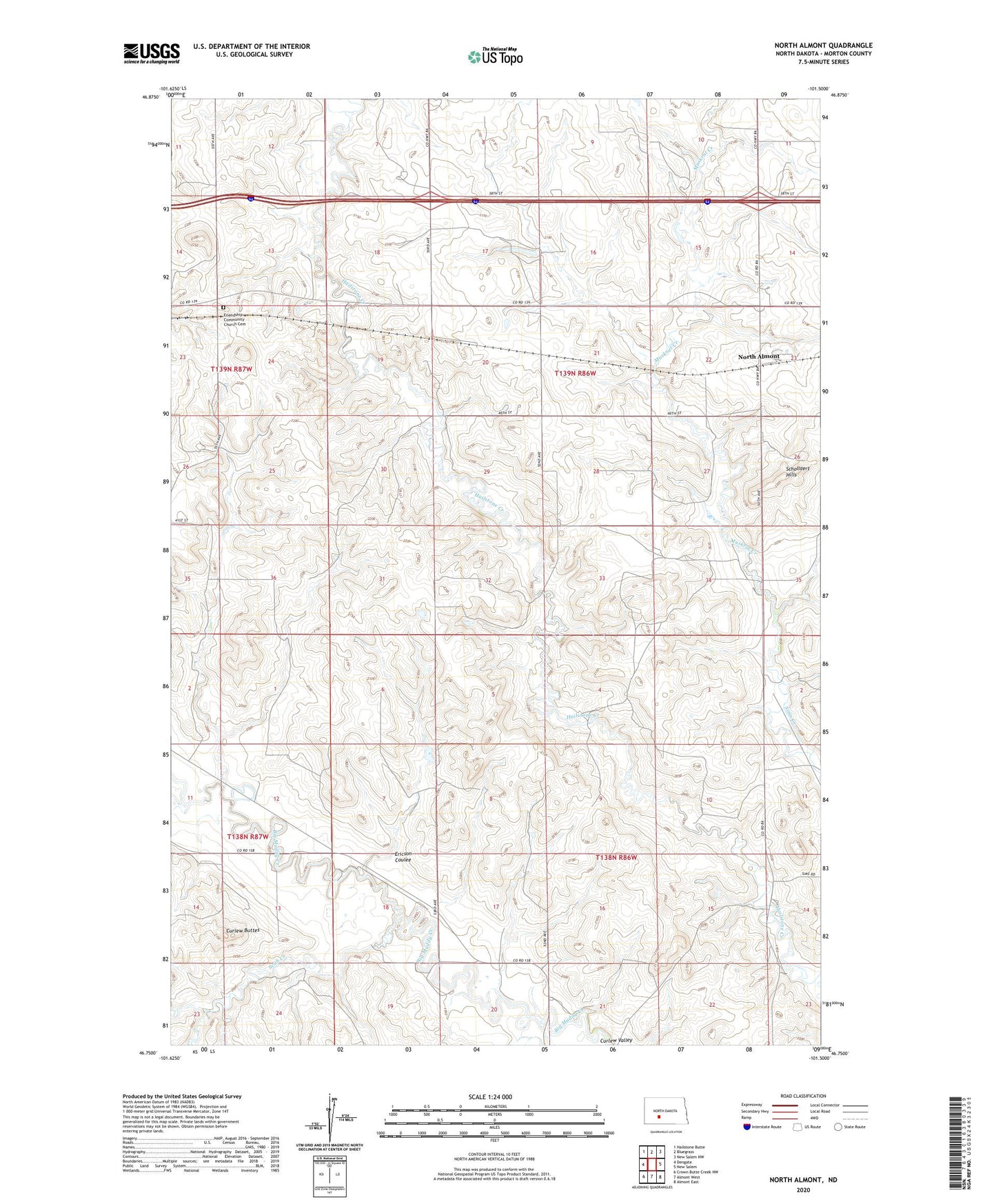
2024 topographic map quadrangle North Almont in the state of North Dakota. Scale: 1:24000. Based on the newly updated USGS 7.5' US Topo map series, this map is in the following counties: Morton. The map contains contour data, water features, and other items you are used to seeing on USGS maps, but also has updated roads and other features. This is the next generation of topographic maps. Printed on high-quality waterproof paper with UV fade-resistant inks.
Quads adjacent to this one:
West: Dengate
Northwest: Hailstone Butte
North: Bluegrass
Northeast: New Salem NW
East: New Salem
Southeast: Almont East
South: Almont West
Southwest: Crown Butte Creek NW
This map covers the same area as the classic USGS quad with code o46101g5.
Contains the following named places: Benson School, Curlew Buttes, English Cemetery, Ericson Coulee, Friendship Community Church Cemetery, Grube Dam, Hailstone Creek East Bound Rest Area, Hailstone Creek West Bound Rest Area, Muskrat Creek, North Almont, Peace Church, Scab Creek, Schollaert Hills