MyTopo
Dickinson South North Dakota US Topo Map
Couldn't load pickup availability
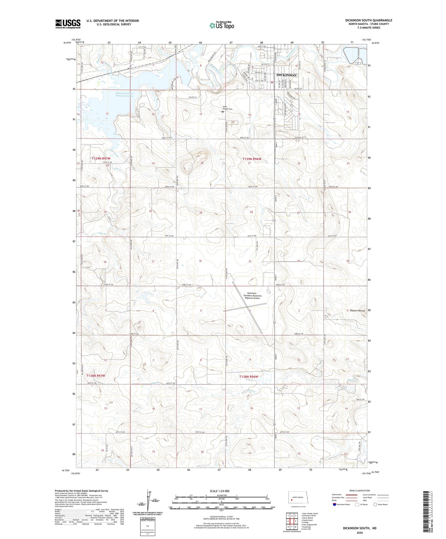
2024 topographic map quadrangle Dickinson South in the state of North Dakota. Scale: 1:24000. Based on the newly updated USGS 7.5' US Topo map series, this map is in the following counties: Stark. The map contains contour data, water features, and other items you are used to seeing on USGS maps, but also has updated roads and other features. This is the next generation of topographic maps. Printed on high-quality waterproof paper with UV fade-resistant inks.
Quads adjacent to this one:
West: South Heart
Northwest: New Hradec South
North: Dickinson North
Northeast: Davis Buttes
East: Lehigh
Southeast: Lefor NW
South: Schefield
Southwest: New England NW
This map covers the same area as the classic USGS quad with code o46102g7.
Contains the following named places: Ash Creek, Dickinson - Theodore Roosevelt Regional Airport, Dickinson Dam, Dickinson Rural Fire District Station, Duck Creek, Edward Arthur Patterson Lake, Heart River Elementary School, KLTC-AM (Dickinson), KRRB-FM (Dickinson), Mann Dam, Queen City Dam, Saint Benedict Home, Saint Joseph Cemetery, Saint Joseph School