MyTopo
South Heart North Dakota US Topo Map
Couldn't load pickup availability
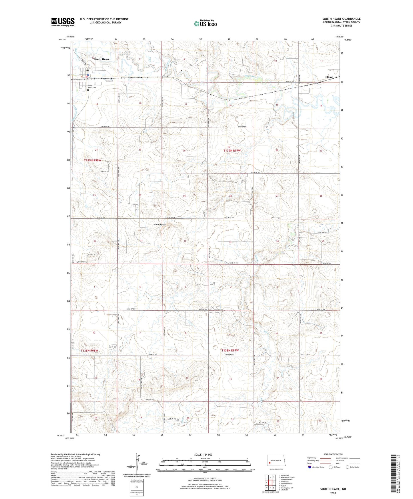
2024 topographic map quadrangle South Heart in the state of North Dakota. Scale: 1:24000. Based on the newly updated USGS 7.5' US Topo map series, this map is in the following counties: Stark. The map contains contour data, water features, and other items you are used to seeing on USGS maps, but also has updated roads and other features. This is the next generation of topographic maps. Printed on high-quality waterproof paper with UV fade-resistant inks.
Quads adjacent to this one:
West: Belfield SE
Northwest: Belfield NE
North: New Hradec South
Northeast: Dickinson North
East: Dickinson South
Southeast: Schefield
South: New England NW
Southwest: Daglum
This map covers the same area as the classic USGS quad with code o46102g8.
Contains the following named places: City of South Heart, Eland, North Creek, Saint Mary's Cemetery, Saint Marys Church, South Heart, South Heart City Hall, South Heart Fire Department, South Heart Police Department, South Heart Post Office, South Heart Public School, White Butte