MyTopo
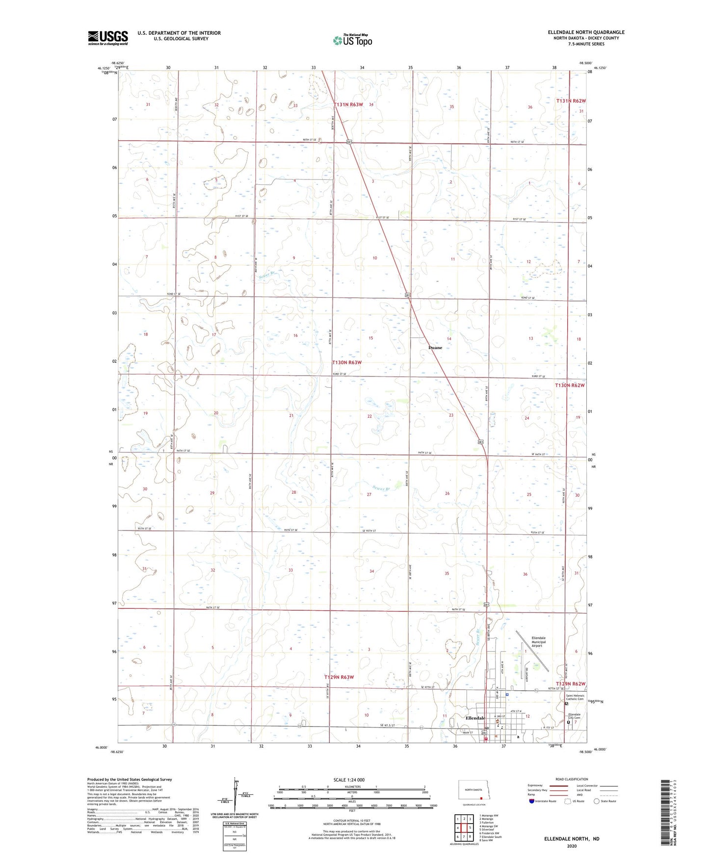
Ellendale North North Dakota US Topo Map
Couldn't load pickup availability
2024 topographic map quadrangle Ellendale North in the state of North Dakota. Scale: 1:24000. Based on the newly updated USGS 7.5' US Topo map series, this map is in the following counties: Dickey. The map contains contour data, water features, and other items you are used to seeing on USGS maps, but also has updated roads and other features. This is the next generation of topographic maps. Printed on high-quality waterproof paper with UV fade-resistant inks.
Quads adjacent to this one:
West: Monango SW
Northwest: Monango NW
North: Monango
Northeast: Fullerton
East: Silverleaf
South: Ellendale South
This map covers the same area as the classic USGS quad with code o46098a5.
Contains the following named places: Block Memorial Chapel, City of Ellendale, Coleman Museum, Davidson Hall, Dickey County, Dickey County Courthouse, Dickey County Sheriff's Office, Duane, Elden Town Hall, Ellendale, Ellendale City Cemetery, Ellendale City Hall, Ellendale Community Ambulance Service, Ellendale Community Center, Ellendale Fire Protection District Station, Ellendale Municipal Airport, Ellendale Police Department, Ellendale Post Office, Ellendale Public Library, Ellendale Public School, Englar Hall, Farming Valley School Number 2, Farming Valley School Number 3, Fern and John Liechty Fitness Center, Flemmington Hall, Fred J Graham Library, Kessler Dorm, Liechty Hall, Lowell Lundstrom Heartland Student Life Center, Prince of Peace Care Center, Riffe Dorm, Saint Helena's Catholic Cemetery, Township of Elden, Trinity Bible College, ZIP Code: 58436