MyTopo
Fullerton North Dakota US Topo Map
Couldn't load pickup availability
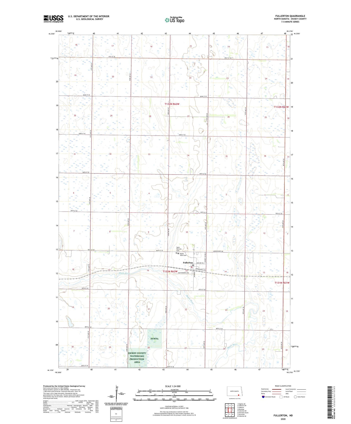
2024 topographic map quadrangle Fullerton in the state of North Dakota. Scale: 1:24000. Based on the newly updated USGS 7.5' US Topo map series, this map is in the following counties: Dickey. The map contains contour data, water features, and other items you are used to seeing on USGS maps, but also has updated roads and other features. This is the next generation of topographic maps. Printed on high-quality waterproof paper with UV fade-resistant inks.
Quads adjacent to this one:
West: Monango
Northwest: Edgeley SE
North: LaMoure SW
Northeast: LaMoure
East: Fullerton NE
Southeast: Fullerton SE
South: Silverleaf
Southwest: Ellendale North
This map covers the same area as the classic USGS quad with code o46098b4.
Contains the following named places: City of Fullerton, Fullerton, Fullerton Fire Department, Fullerton Post Office, Larson Landing Strip, Leiseth Farms Landing Strip, Maple View Cemetery, Porter Town Hall, Rosebud School Museum, Saint Patricks Cemetery, Township of Keystone, Township of Maple, Township of Porter, Township of Valley