MyTopo
Emmet SE North Dakota US Topo Map
Couldn't load pickup availability
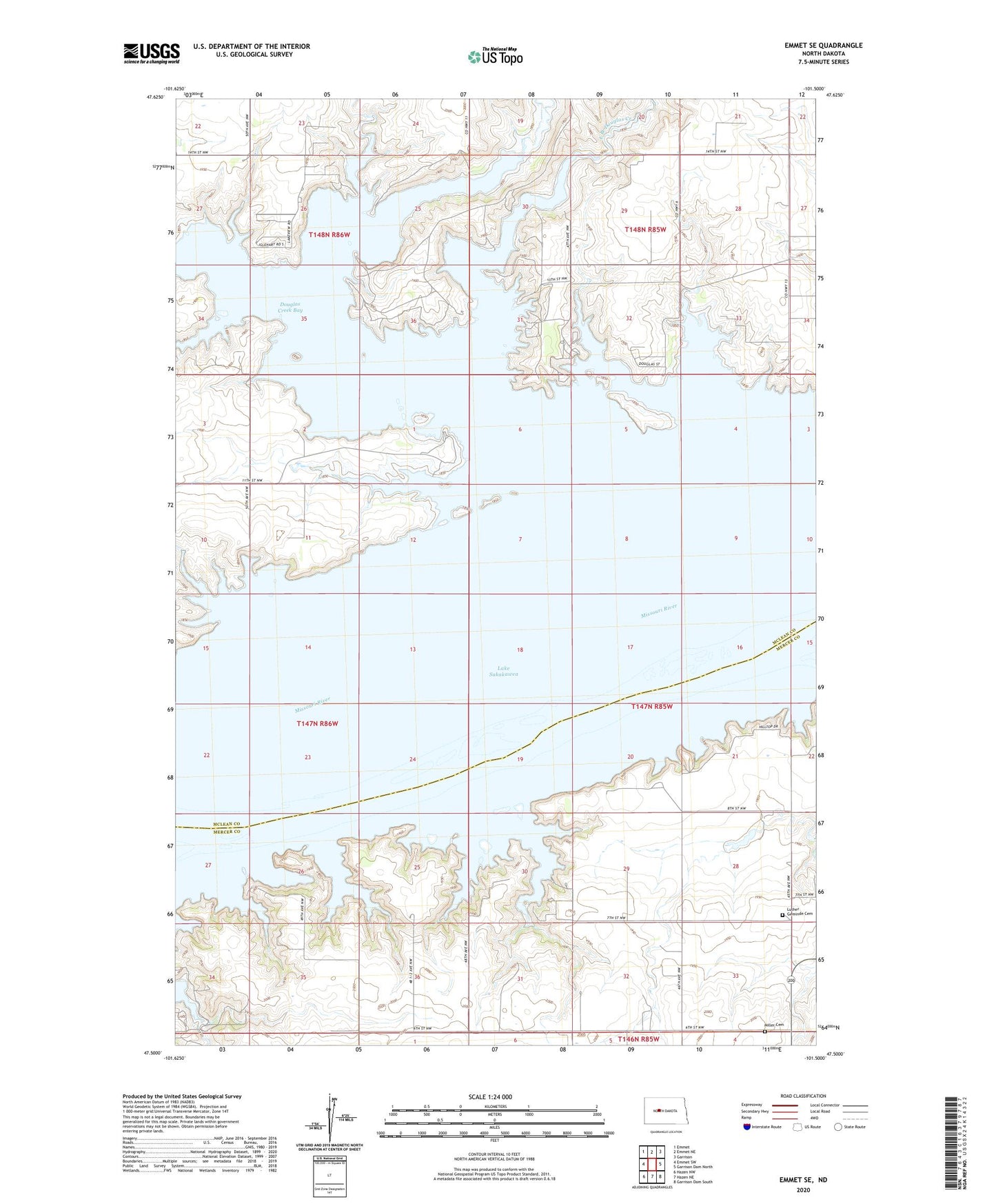
2024 topographic map quadrangle Emmet SE in the state of North Dakota. Scale: 1:24000. Based on the newly updated USGS 7.5' US Topo map series, this map is in the following counties: McLean, Mercer. The map contains contour data, water features, and other items you are used to seeing on USGS maps, but also has updated roads and other features. This is the next generation of topographic maps. Printed on high-quality waterproof paper with UV fade-resistant inks.
Quads adjacent to this one:
West: Emmet SW
Northwest: Emmet
North: Emmet NE
Northeast: Garrison
East: Garrison Dam North
Southeast: Garrison Dam South
South: Hazen NE
Southwest: Hazen NW
This map covers the same area as the classic USGS quad with code o47101e5.
Contains the following named places: Douglas Creek Bay, Douglas Creek Public Use Area, Douglas Creek State Game Management Area, East Branch Douglas Creek, Emanuel Rock, Luther Geminde Cemetery, Middle Branch Douglas Creek, Miller Cemetery, Snake Creek Dam, Triangle Camp