MyTopo
Enderlin South North Dakota US Topo Map
Couldn't load pickup availability
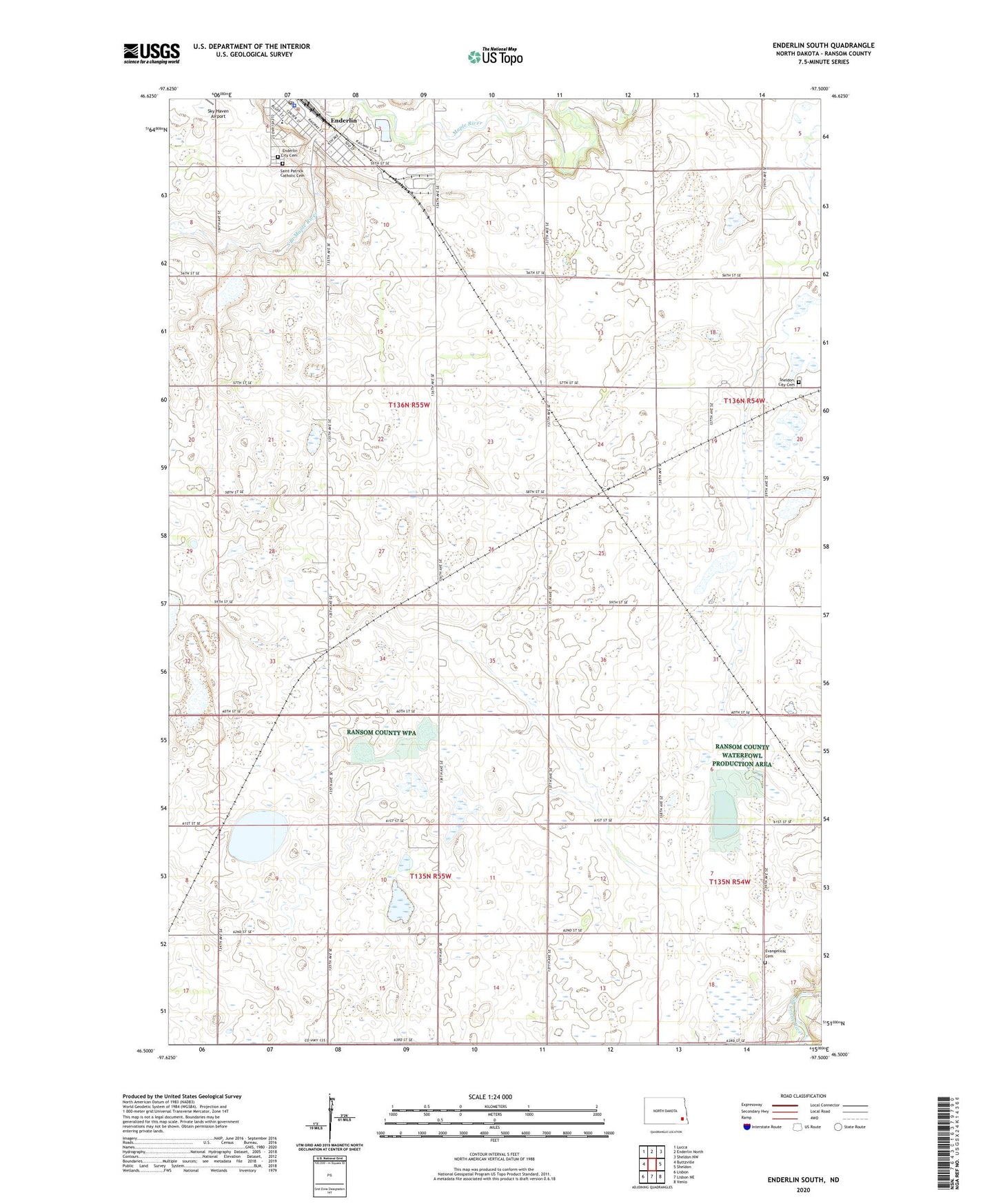
2024 topographic map quadrangle Enderlin South in the state of North Dakota. Scale: 1:24000. Based on the newly updated USGS 7.5' US Topo map series, this map is in the following counties: Ransom. The map contains contour data, water features, and other items you are used to seeing on USGS maps, but also has updated roads and other features. This is the next generation of topographic maps. Printed on high-quality waterproof paper with UV fade-resistant inks.
Quads adjacent to this one:
West: Buttzville
Northwest: Lucca
North: Enderlin North
Northeast: Sheldon NW
East: Sheldon
Southeast: Venlo
South: Lisbon NE
Southwest: Lisbon
This map covers the same area as the classic USGS quad with code o46097e5.
Contains the following named places: City of Enderlin, Enderlin, Enderlin Area Public School, Enderlin City Cemetery, Enderlin City Hall, Enderlin Municipal Library, Enderlin Museum, Enderlin Park Dam, Enderlin Police Department, Enderlin Post Office, Evangelical Cemetery, Liberty Town Hall, Saint Patrick Catholic Cemetery, Sheldon City Cemetery, South Branch Maple River, Township of Casey, Township of Liberty, Trinity Church