MyTopo
Fairmount North Dakota US Topo Map
Couldn't load pickup availability
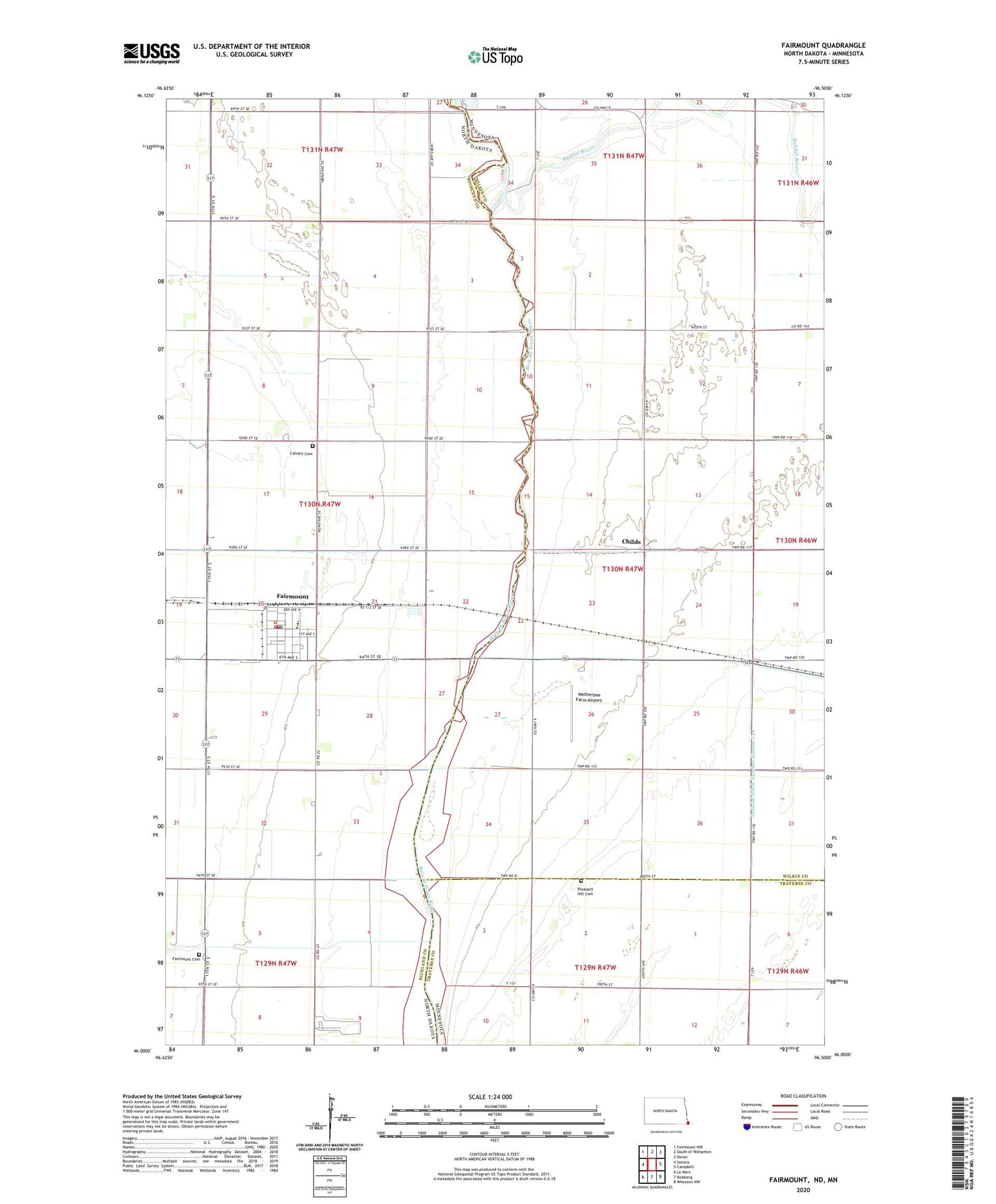
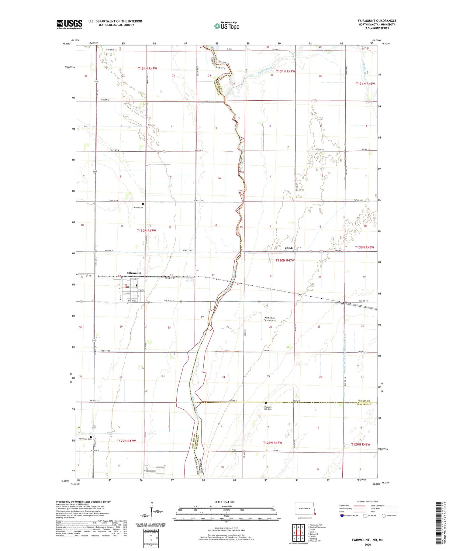
2020 topographic map quadrangle Fairmount in the states of Minnesota, North Dakota. Scale: 1:24000. Based on the newly updated USGS 7.5' US Topo map series, this map is in the following counties: Richland, Wilkin, Traverse. The map contains contour data, water features, and other items you are used to seeing on USGS maps, but also has updated roads and other features. This is the next generation of topographic maps. Printed on high-quality waterproof paper with UV fade-resistant inks.
Quads adjacent to this one:
West: Sonora
Northwest: Fairmount NW
North: South of Wahpeton
Northeast: Doran
East: Campbell
Southeast: Wheaton NW
South: Boisberg
Southwest: La Mars
Contains the following named places: Calvary Cemetery, Childs, Childs Post Office, City of Fairmount, County Ditch Number 26, County Ditch Number 34, County Ditch Number 35, County Ditch Number 58, County Ditch Number Thirtynine, County Ditch Number Twentyfive, Fairmount, Fairmount Cemetery, Fairmount City Hall, Fairmount Fire Protection District, Fairmount Post Office, Fairmount Public School, Judicial Ditch Number Eleven-Ten, Pleasant Hill Cemetery, Rabbit River, Saint Pauls Church, Township of Fairmount, Wetherbee Farm Airport