MyTopo
Doran Minnesota US Topo Map
Couldn't load pickup availability
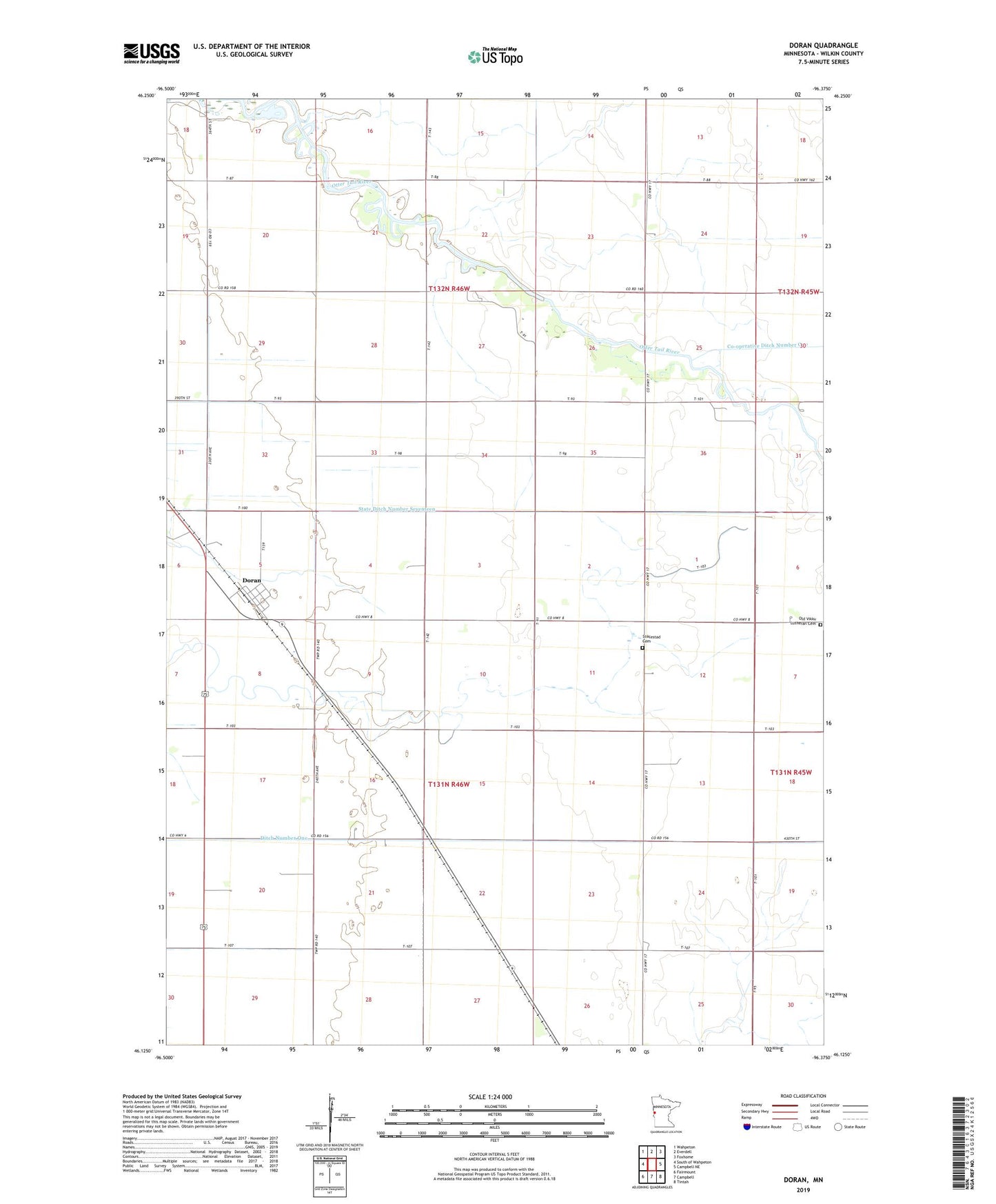
2022 topographic map quadrangle Doran in the state of Minnesota. Scale: 1:24000. Based on the newly updated USGS 7.5' US Topo map series, this map is in the following counties: Wilkin. The map contains contour data, water features, and other items you are used to seeing on USGS maps, but also has updated roads and other features. This is the next generation of topographic maps. Printed on high-quality waterproof paper with UV fade-resistant inks.
Quads adjacent to this one:
West: South of Wahpeton
Northwest: Wahpeton
North: Everdell
Northeast: Foxhome
East: Campbell NE
Southeast: Tintah
South: Campbell
Southwest: Fairmount
This map covers the same area as the classic USGS quad with code o46096b4.
Contains the following named places: City of Doran, County Ditch Number Thirtyfive, Ditch Number One, Doran, Doran Post Office, Old Vikku Lutheran Cemetery, School Number 42, State Ditch Number Seventeen, Sticklestad Church, Stiklestad Cemetery, Sunnyside School, Sunnyside Township State Game Refuge, Township of Brandrup, Township of Sunnyside, ZIP Code: 56522