MyTopo
Boisberg Minnesota US Topo Map
Couldn't load pickup availability
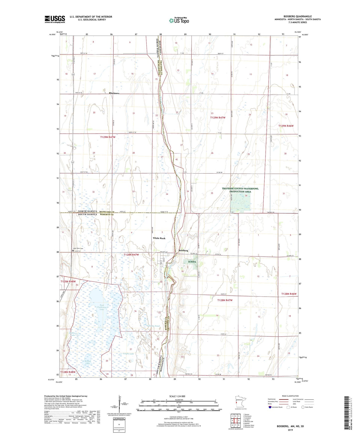
2022 topographic map quadrangle Boisberg in the states of Minnesota, South Dakota, North Dakota. Scale: 1:24000. Based on the newly updated USGS 7.5' US Topo map series, this map is in the following counties: Traverse, Richland, Roberts. The map contains contour data, water features, and other items you are used to seeing on USGS maps, but also has updated roads and other features. This is the next generation of topographic maps. Printed on high-quality waterproof paper with UV fade-resistant inks.
Quads adjacent to this one:
West: La Mars
Northwest: Sonora
North: Fairmount
Northeast: Campbell
East: Wheaton NW
Southeast: Wheaton East
South: Wheaton West
Southwest: Rosholt
Contains the following named places: Beyer Airport, Blackmer, Boisberg, Bruce School, Clubhouse Lake, Drain Number 39, East Clubhouse Lake, Gibsons Pond, Lake View Cemetery, Mollison Lake, Round Lake, School Number 1, School Number 40, Town of White Rock, Upper Lake Traverse State Wildlife Management Area, Voight Lake, White Rock, White Rock Colony