MyTopo
Flasher North Dakota US Topo Map
Couldn't load pickup availability
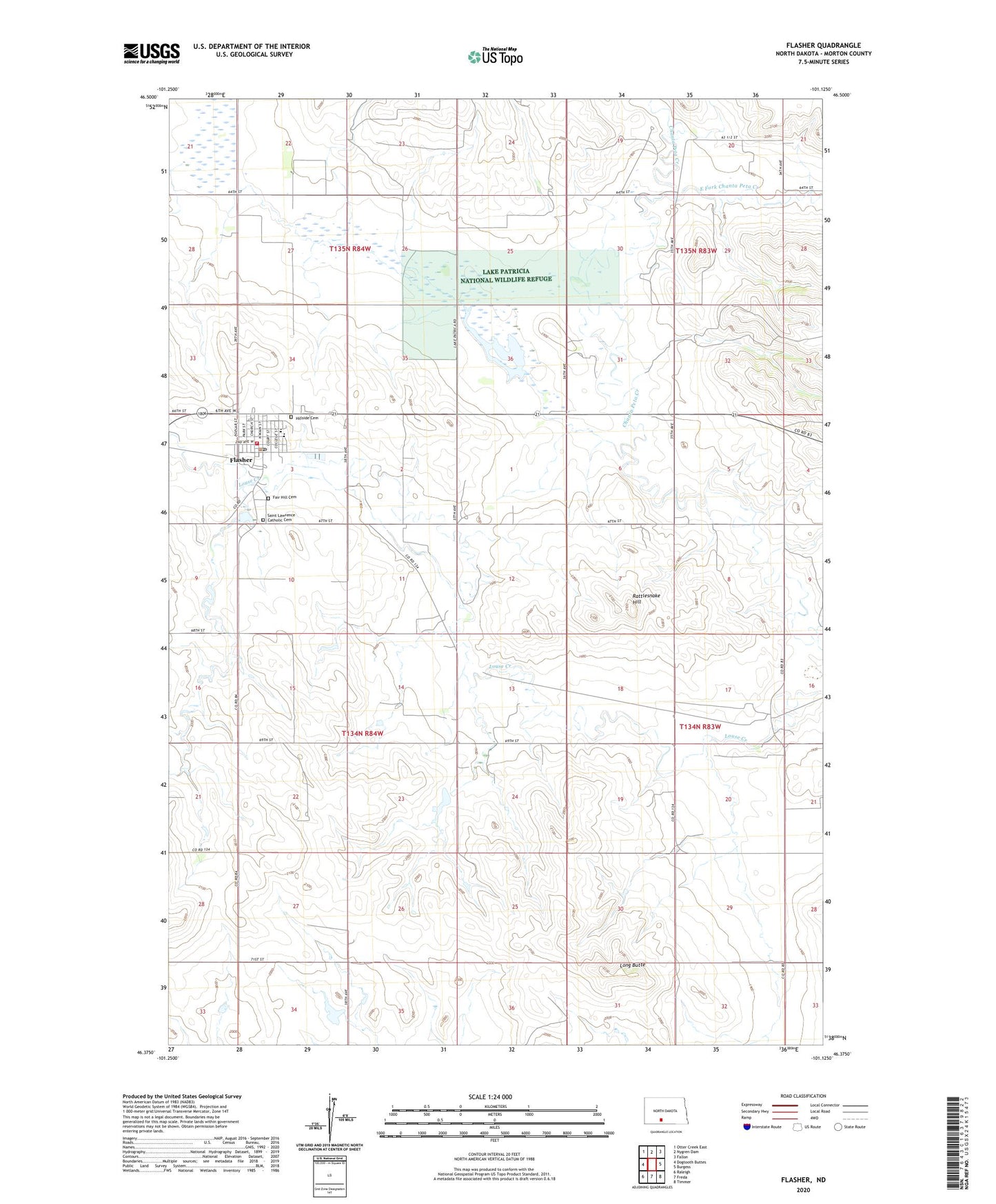
2024 topographic map quadrangle Flasher in the state of North Dakota. Scale: 1:24000. Based on the newly updated USGS 7.5' US Topo map series, this map is in the following counties: Morton. The map contains contour data, water features, and other items you are used to seeing on USGS maps, but also has updated roads and other features. This is the next generation of topographic maps. Printed on high-quality waterproof paper with UV fade-resistant inks.
Quads adjacent to this one:
West: Dogtooth Buttes
Northwest: Otter Creek East
North: Nygren Dam
Northeast: Fallon
East: Burgess
Southeast: Timmer
South: Freda
Southwest: Raleigh
This map covers the same area as the classic USGS quad with code o46101d2.
Contains the following named places: City of Flasher, East Fork Chanta Peta Creek, Fair Hill Cemetery, Flasher, Flasher Ambulance Service, Flasher City Hall, Flasher Dam, Flasher Fire Department, Flasher Post Office, Flasher Public School, Hillside Cemetery, Lake Patricia, Lake Patricia Dam, Lake Patricia National Wildlife Refuge, Lake Patricia State Game Management Area, Long Butte, Rattlesnake Hill, Saint Lawrence Catholic Cemetery