MyTopo
Timmer North Dakota US Topo Map
Couldn't load pickup availability
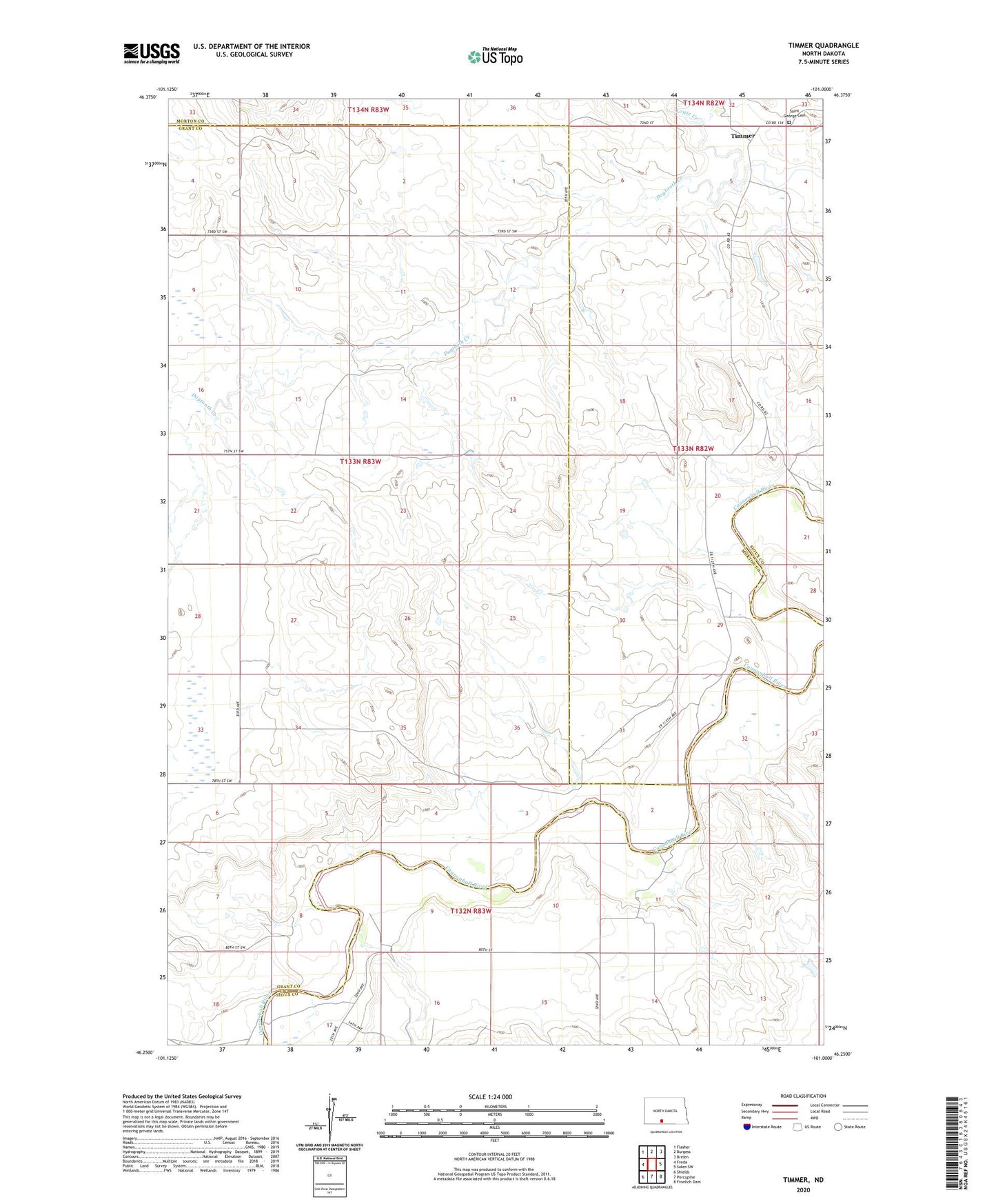
2024 topographic map quadrangle Timmer in the state of North Dakota. Scale: 1:24000. Based on the newly updated USGS 7.5' US Topo map series, this map is in the following counties: Grant, Morton, Sioux. The map contains contour data, water features, and other items you are used to seeing on USGS maps, but also has updated roads and other features. This is the next generation of topographic maps. Printed on high-quality waterproof paper with UV fade-resistant inks.
Quads adjacent to this one:
West: Freda
Northwest: Flasher
North: Burgess
Northeast: Breien
East: Solen SW
Southeast: Froelich Dam
South: Porcupine
Southwest: Shields
This map covers the same area as the classic USGS quad with code o46101c1.
Contains the following named places: Louse Creek, Saint George Cemetery, Timmer, Township of Freda