MyTopo
Flat Rock Butte North Dakota US Topo Map
Couldn't load pickup availability
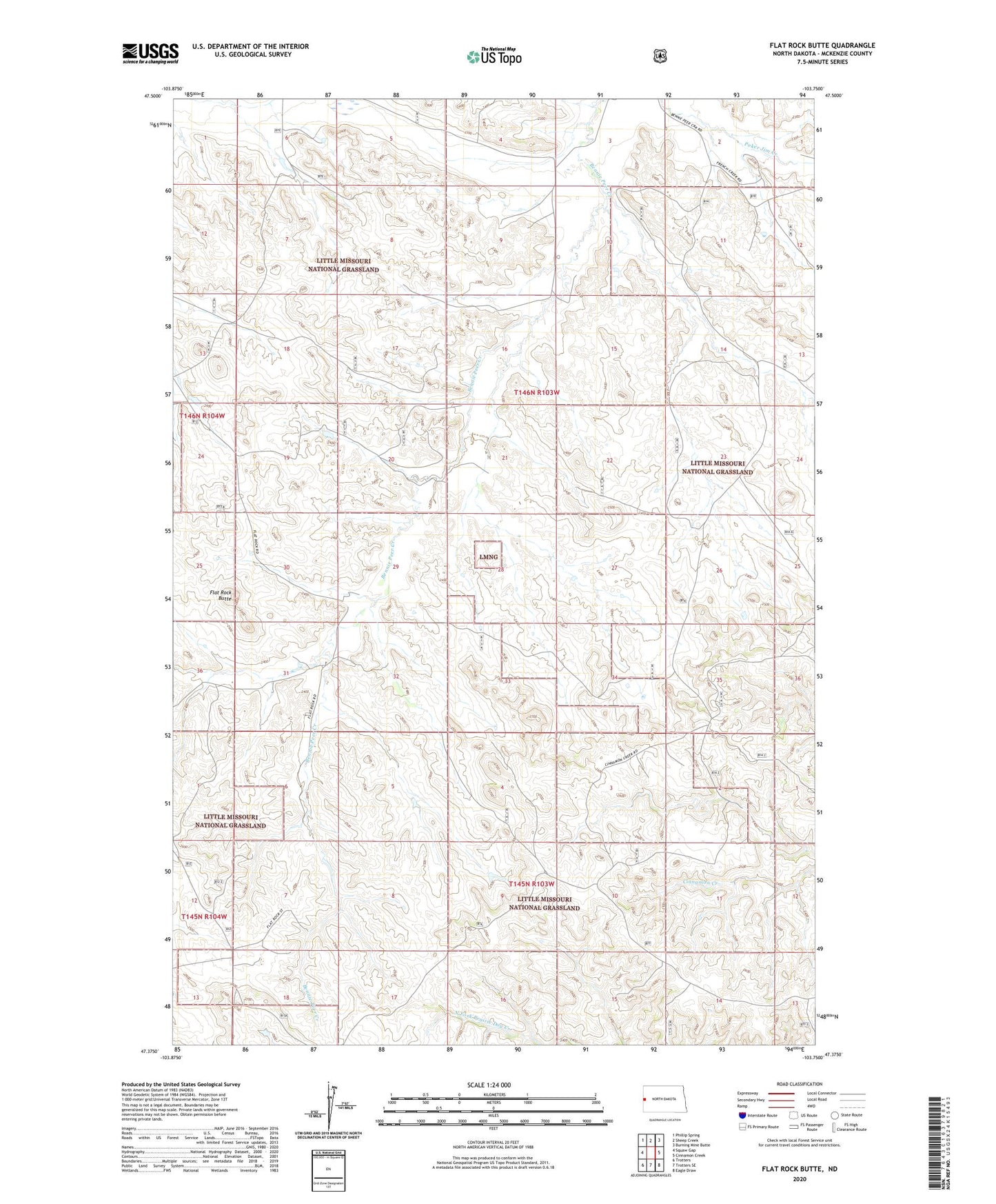
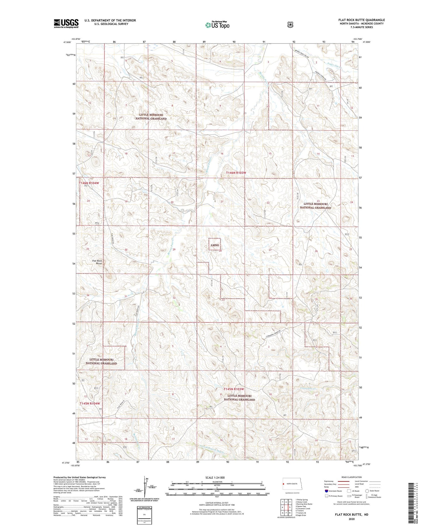
2020 topographic map quadrangle Flat Rock Butte in the state of North Dakota. Scale: 1:24000. Based on the newly updated USGS 7.5' US Topo map series, this map is in the following counties: McKenzie. The map contains contour data, water features, and other items you are used to seeing on USGS maps, but also has updated roads and other features. This is the next generation of topographic maps. Printed on high-quality waterproof paper with UV fade-resistant inks.
Quads adjacent to this one:
West: Squaw Gap
Northwest: Phillip Spring
North: Sheep Creek
Northeast: Burning Mine Butte
East: Cinnamon Creek
Southeast: Eagle Draw
South: Trotters SE
Southwest: Trotters
Contains the following named places: Bicentennial Oil Field, Bicentennial Substations, C Fitzgerald Ranch, Flat Rock Butte, Flat Rock Ranch, Poker Jim Oilfield, Rindahl Ranch, Rivet Ranch