MyTopo
Phillip Spring North Dakota US Topo Map
Couldn't load pickup availability
Also explore the Phillip Spring Forest Service Topo of this same quad for updated USFS data
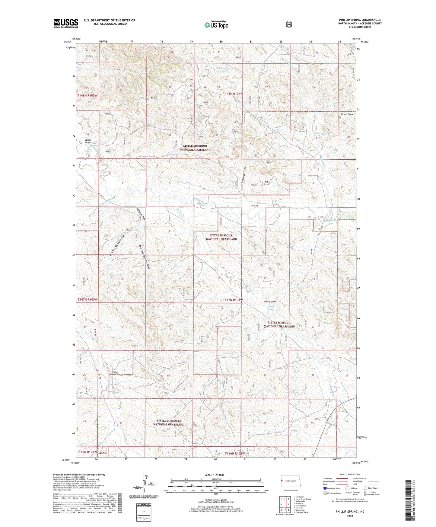
2024 topographic map quadrangle Phillip Spring in the state of North Dakota. Scale: 1:24000. Based on the newly updated USGS 7.5' US Topo map series, this map is in the following counties: McKenzie. The map contains contour data, water features, and other items you are used to seeing on USGS maps, but also has updated roads and other features. This is the next generation of topographic maps. Printed on high-quality waterproof paper with UV fade-resistant inks.
Quads adjacent to this one:
West: Sidney SE
Northwest: Sidney NE
North: Horse Creek School
Northeast: Sather Lake
East: Sheep Creek
Southeast: Flat Rock Butte
South: Squaw Gap
Southwest: Skaar NE
This map covers the same area as the classic USGS quad with code o47103e8.
Contains the following named places: Badlands Draw, Corral Draw, East Fork Badlands Draw, H Wersiano Ranch, Interstate Land and Cattle, Klandl Spring, L Ronningen Ranch, McPeak Creek, McPeak Spring, One-O-One Creek, Phillip Draw, Phillip Spring, R Hotter Ranch, R Leland Ranch, Ronningen Draw, Spring Creek, West Fork Badlands Draw, Wheeling-Hatter Ranch