MyTopo
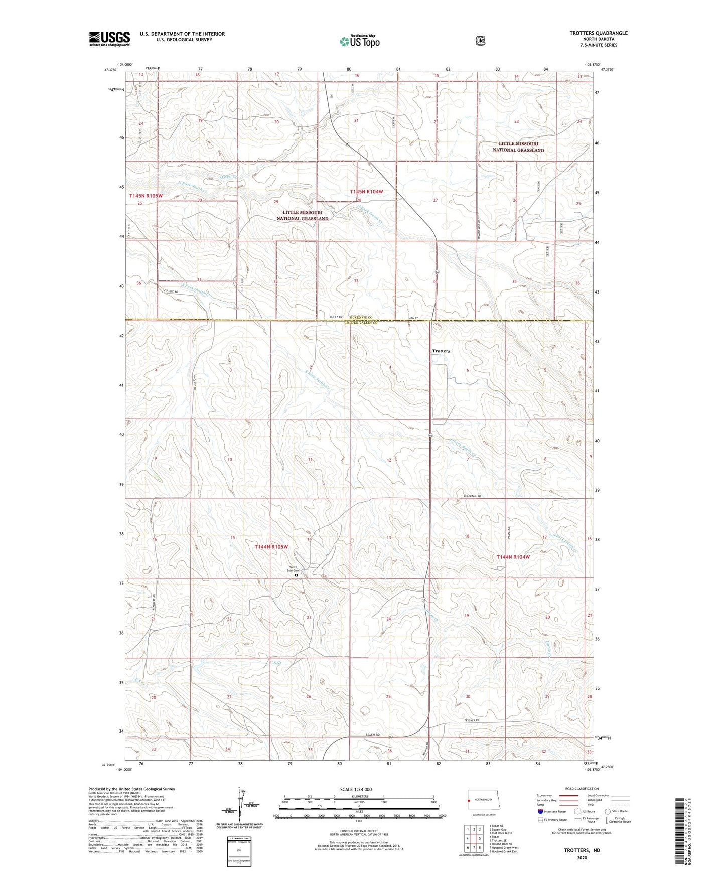
Trotters North Dakota US Topo Map
Couldn't load pickup availability
Also explore the Trotters Forest Service Topo of this same quad for updated USFS data
2024 topographic map quadrangle Trotters in the state of North Dakota. Scale: 1:24000. Based on the newly updated USGS 7.5' US Topo map series, this map is in the following counties: Golden Valley, McKenzie. The map contains contour data, water features, and other items you are used to seeing on USGS maps, but also has updated roads and other features. This is the next generation of topographic maps. Printed on high-quality waterproof paper with UV fade-resistant inks.
Quads adjacent to this one:
West: Skaar
Northwest: Skaar NE
North: Squaw Gap
Northeast: Flat Rock Butte
East: Trotters SE
Southeast: Hootowl Creek East
South: Hootowl Creek West
Southwest: Odland Dam NE
This map covers the same area as the classic USGS quad with code o47103c8.
Contains the following named places: Gorrell Ranch, O'Neil Creek, Smith Ranch, South Side Cemetery, Tasker Ranch, Trotters