MyTopo
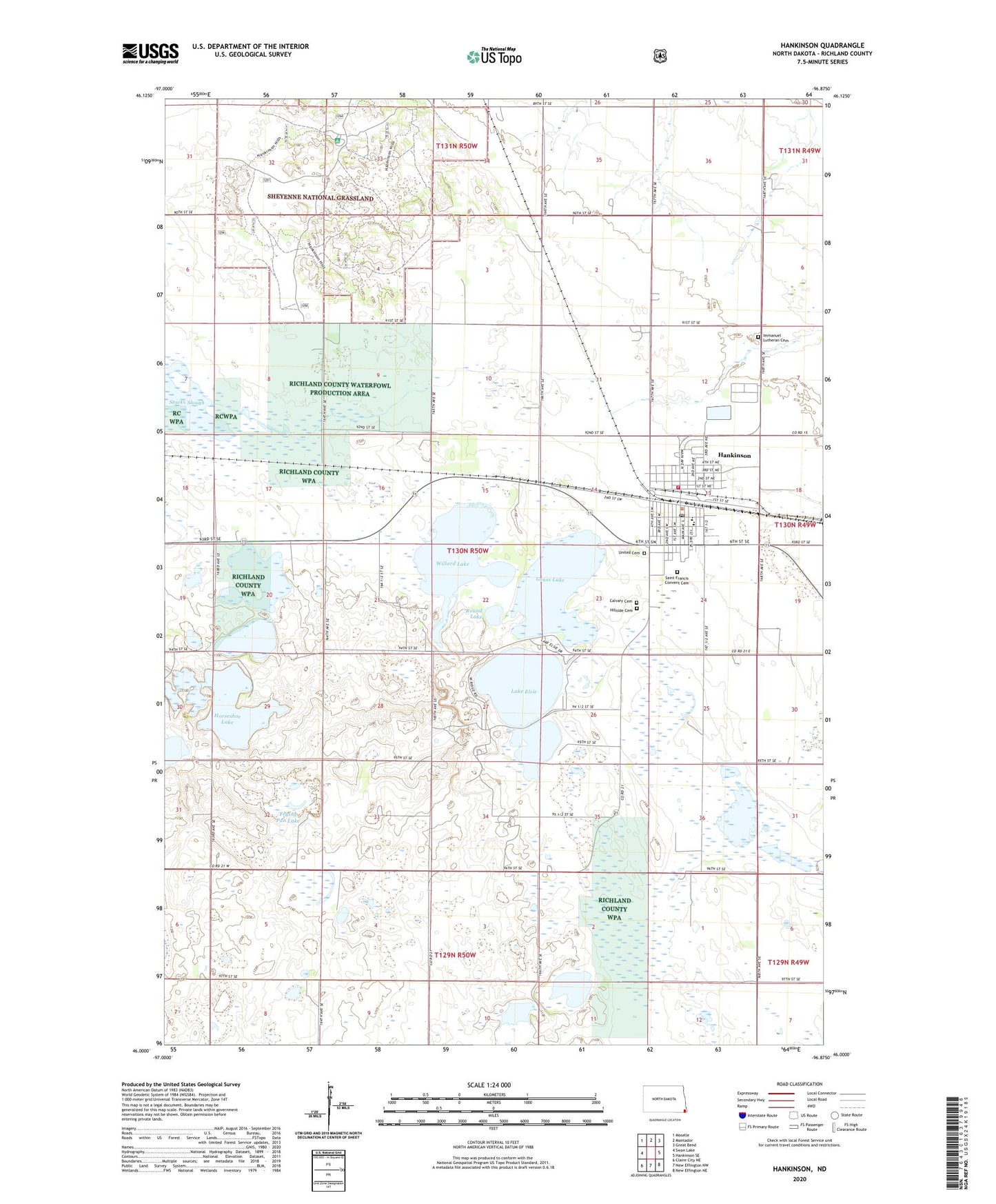
Hankinson North Dakota US Topo Map
Couldn't load pickup availability
Also explore the Hankinson Forest Service Topo of this same quad for updated USFS data
2024 topographic map quadrangle Hankinson in the state of North Dakota. Scale: 1:24000. Based on the newly updated USGS 7.5' US Topo map series, this map is in the following counties: Richland. The map contains contour data, water features, and other items you are used to seeing on USGS maps, but also has updated roads and other features. This is the next generation of topographic maps. Printed on high-quality waterproof paper with UV fade-resistant inks.
Quads adjacent to this one:
West: Swan Lake
Northwest: Moselle
North: Mantador
Northeast: Great Bend
East: Hankinson SE
Southeast: New Effington NE
South: New Effington NW
Southwest: Claire City NE
This map covers the same area as the classic USGS quad with code o46096a8.
Contains the following named places: Brightwood Town Hall, Calvary Cemetery, City of Hankinson, Coppin Cemetery, Frying Pan Lake, Grass Lake, Hankinson, Hankinson City Hall, Hankinson Post Office, Hankinson Public Library, Hankinson Public School, Hankinson Volunteer Fire Department, Hillside Cemetery, Horseshoe Lake, Immanuel Lutheran Cemetery, Lake Elsie, Lake Elsie National Wildlife Refuge, Richland County Water Plant, Richland County Waterfowl Production Area, Round Lake, Saint Francis Convent Cemetery, Saint Gerard's Community of Care, School Number 2, Township of Brightwood, United Cemetery, Willard Lake, ZIP Code: 58041