MyTopo
Kathryn North Dakota US Topo Map
Couldn't load pickup availability
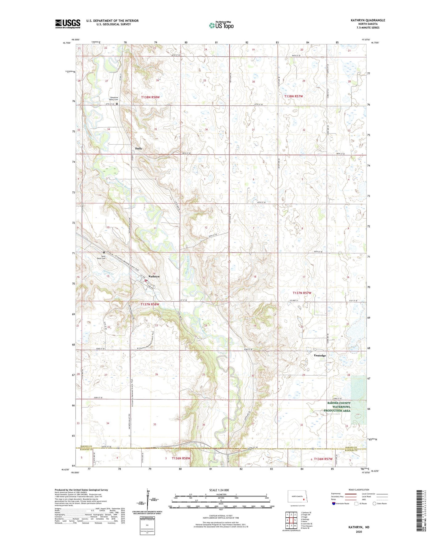
2024 topographic map quadrangle Kathryn in the state of North Dakota. Scale: 1:24000. Based on the newly updated USGS 7.5' US Topo map series, this map is in the following counties: Barnes, Ransom. The map contains contour data, water features, and other items you are used to seeing on USGS maps, but also has updated roads and other features. This is the next generation of topographic maps. Printed on high-quality waterproof paper with UV fade-resistant inks.
Quads adjacent to this one:
West: Hastings
Northwest: Sanborn SE
North: Fingal SW
Northeast: Fingal
East: Nome
Southeast: Nome SE
South: Fort Ransom
Southwest: Litchville SE
This map covers the same area as the classic USGS quad with code o46097f8.
Contains the following named places: Brown Dam, City of Kathryn, Daily, Eastedge, Kathryn, Kathryn Dam, Kathryn Fire Department, Kathryn Post Office, Little Yellowstone Park, Olesberg, Saint Pauls Cemetery, Sheyenne Valley Cemetery, Sheyenne Valley Church, Spring Creek, Township of Oakhill, Waldhiem Church