MyTopo
Killdeer North Dakota US Topo Map
Couldn't load pickup availability
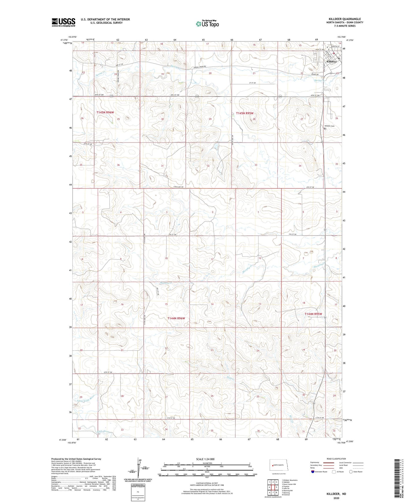
2024 topographic map quadrangle Killdeer in the state of North Dakota. Scale: 1:24000. Based on the newly updated USGS 7.5' US Topo map series, this map is in the following counties: Dunn. The map contains contour data, water features, and other items you are used to seeing on USGS maps, but also has updated roads and other features. This is the next generation of topographic maps. Printed on high-quality waterproof paper with UV fade-resistant inks.
Quads adjacent to this one:
West: Fayette
Northwest: Killdeer Mountains
North: Oakdale
Northeast: Dunn Center NW
East: Lake Ilo
Southeast: Emerson
South: Manning
Southwest: Manning NW
This map covers the same area as the classic USGS quad with code o47102c7.
Contains the following named places: Hill Top Home of Comfort, Killdeer, Killdeer Area Ambulance Service, Killdeer Cemetery, Killdeer Post Office, Killdeer Public School, Killdeer School and Public Library, Little Knife River, West Dunn Fire District Station