MyTopo
Manning North Dakota US Topo Map
Couldn't load pickup availability
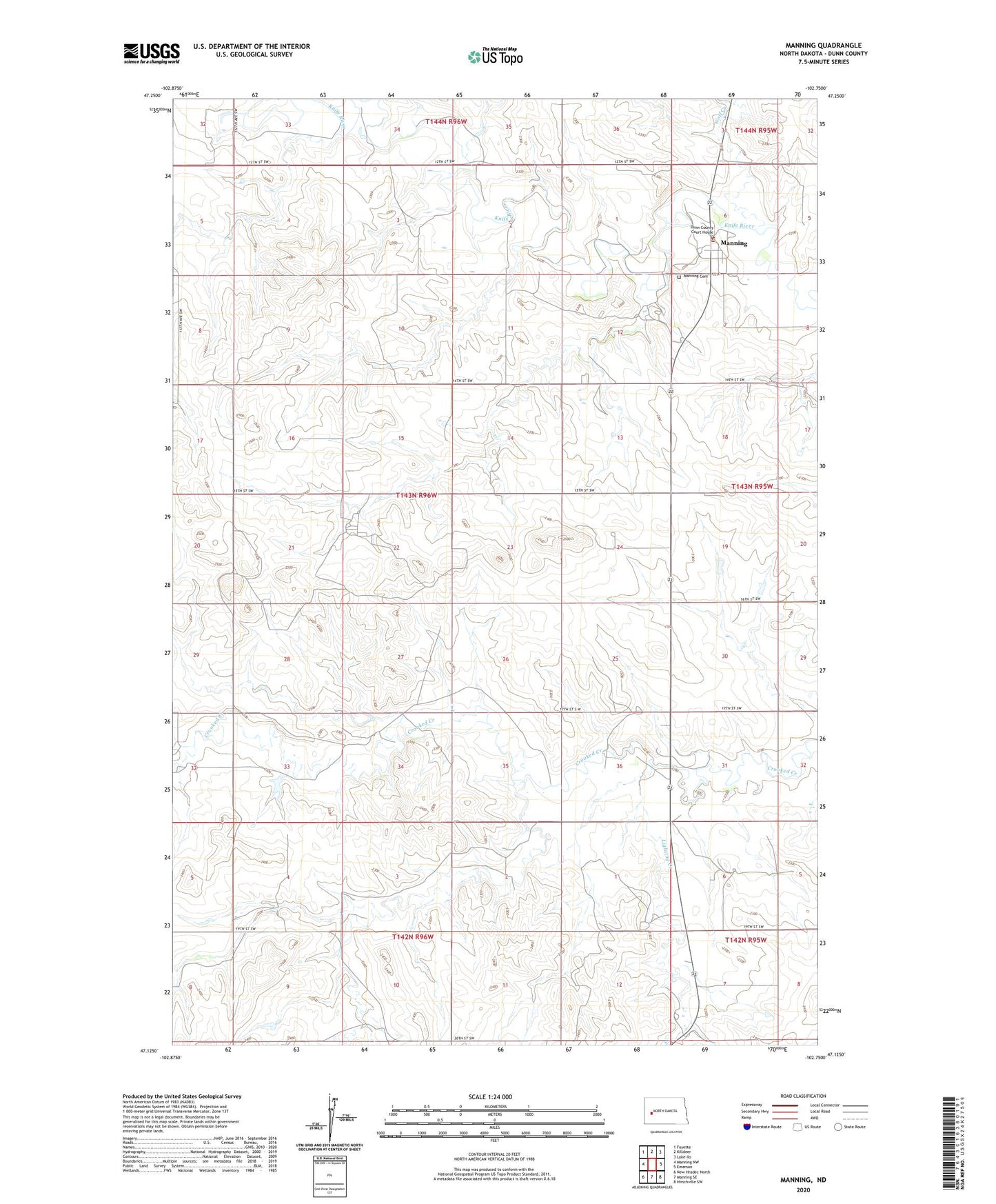
2024 topographic map quadrangle Manning in the state of North Dakota. Scale: 1:24000. Based on the newly updated USGS 7.5' US Topo map series, this map is in the following counties: Dunn. The map contains contour data, water features, and other items you are used to seeing on USGS maps, but also has updated roads and other features. This is the next generation of topographic maps. Printed on high-quality waterproof paper with UV fade-resistant inks.
Quads adjacent to this one:
West: Manning NW
Northwest: Fayette
North: Killdeer
Northeast: Lake Ilo
East: Emerson
Southeast: Hirschville SW
South: Manning SE
Southwest: New Hradec North
This map covers the same area as the classic USGS quad with code o47102b7.
Contains the following named places: Dunn County Courthouse, Dunn County Sheriff's Office, Lighting Creek, Manning, Manning Cemetery, Manning Census Designated Place, Manning Post Office, Wolf Creek, ZIP Code: 58642