MyTopo
Lidgerwood North Dakota US Topo Map
Couldn't load pickup availability
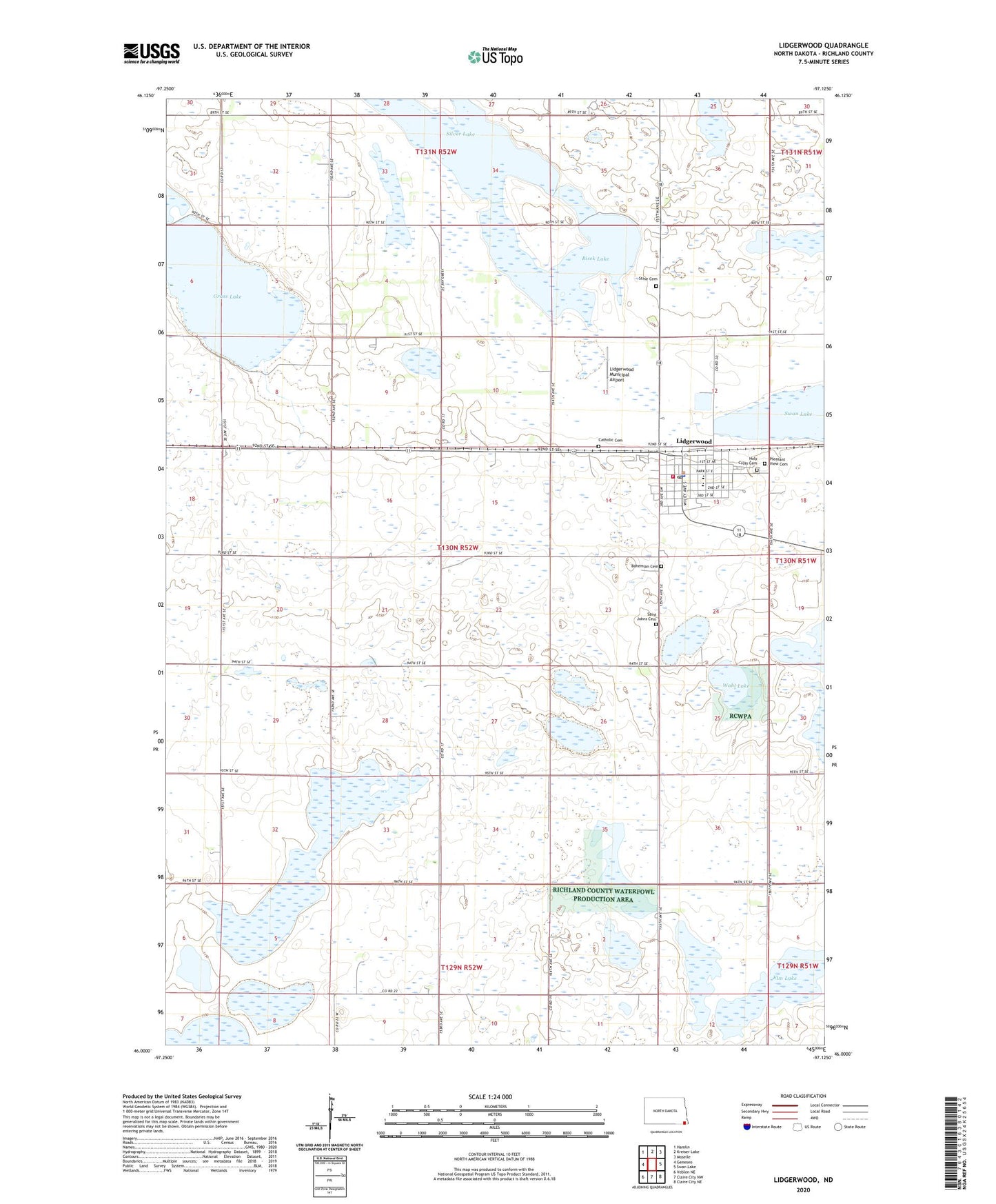
2024 topographic map quadrangle Lidgerwood in the state of North Dakota. Scale: 1:24000. Based on the newly updated USGS 7.5' US Topo map series, this map is in the following counties: Richland. The map contains contour data, water features, and other items you are used to seeing on USGS maps, but also has updated roads and other features. This is the next generation of topographic maps. Printed on high-quality waterproof paper with UV fade-resistant inks.
Quads adjacent to this one:
West: Geneseo
Northwest: Hamlin
North: Kreiser Lake
Northeast: Moselle
East: Swan Lake
Southeast: Claire City NE
South: Claire City NW
Southwest: Veblen NE
This map covers the same area as the classic USGS quad with code o46097a2.
Contains the following named places: Bisek Lake, Bohemian Cemetery, Catholic Cemetery, City of Lidgerwood, Elm Lake, Grant Town Hall, Grass Lake, Holy Cross Cemetery, Lidgerwood, Lidgerwood City Hall, Lidgerwood City Library, Lidgerwood Community Ambulance Service, Lidgerwood Community Museum, Lidgerwood Fire Department, Lidgerwood Municipal Airport, Lidgerwood Police Department, Lidgerwood Post Office, Lidgerwood Public School, Pleasant View Cemetery, Saint Johns Cemetery, Silver Lake, Stine Cemetery, Township of Grant, Wahl Lake, ZIP Code: 58053