MyTopo
Lookout Butte North Dakota US Topo Map
Couldn't load pickup availability
Also explore the Lookout Butte Forest Service Topo of this same quad for updated USFS data
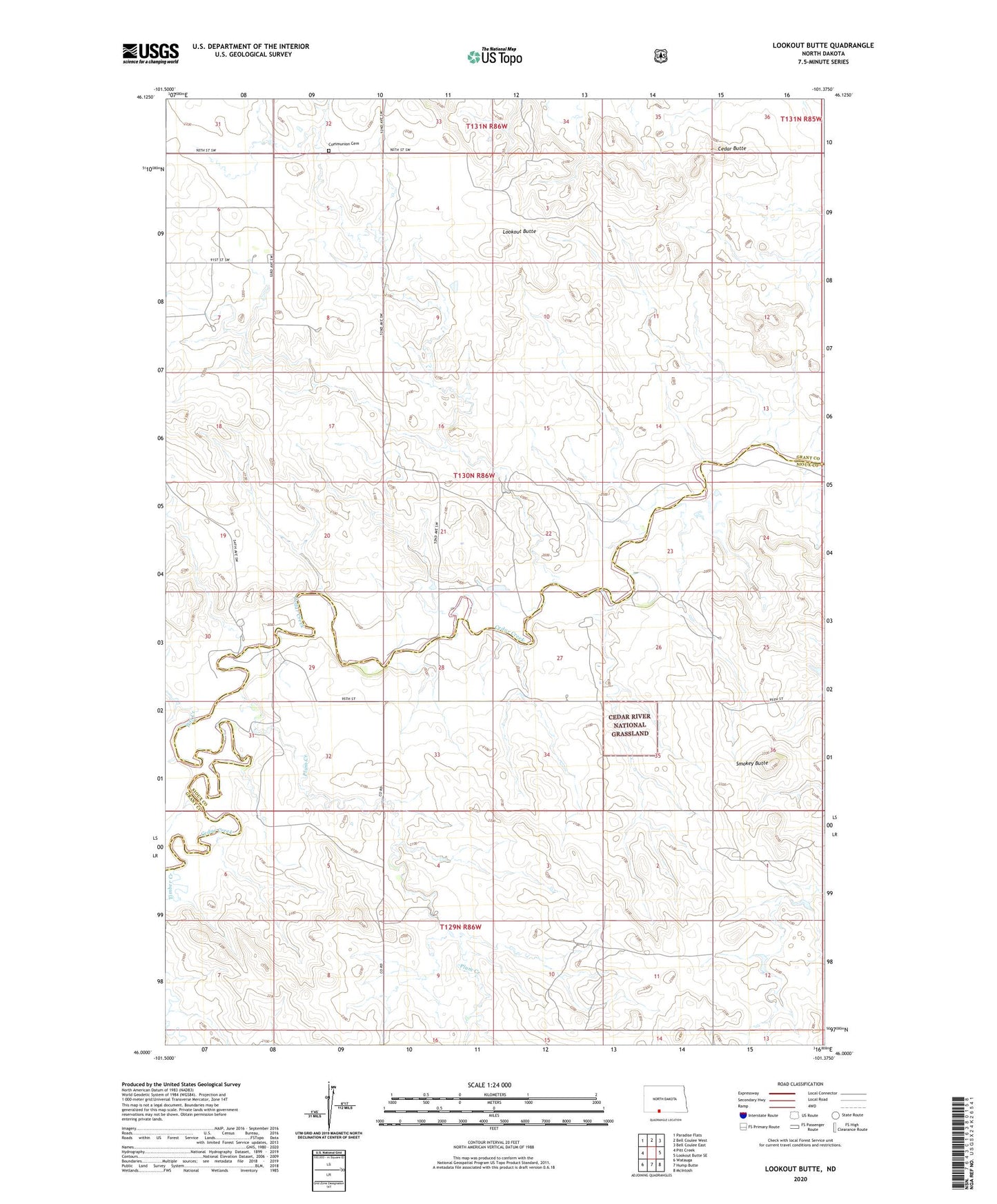
2024 topographic map quadrangle Lookout Butte in the state of North Dakota. Scale: 1:24000. Based on the newly updated USGS 7.5' US Topo map series, this map is in the following counties: Grant, Sioux. The map contains contour data, water features, and other items you are used to seeing on USGS maps, but also has updated roads and other features. This is the next generation of topographic maps. Printed on high-quality waterproof paper with UV fade-resistant inks.
Quads adjacent to this one:
West: Pitt Creek
Northwest: Paradise Flats
North: Bell Coulee West
Northeast: Bell Coulee East
East: Lookout Butte SE
Southeast: McIntosh
South: Hump Butte
Southwest: Watauga
This map covers the same area as the classic USGS quad with code o46101a4.
Contains the following named places: Cedar Butte, Communion Cemetery, Lookout Butte, Pitt Creek, Plum Creek, Smokey Butte, Timber Creek