MyTopo
McIntosh South Dakota US Topo Map
Couldn't load pickup availability
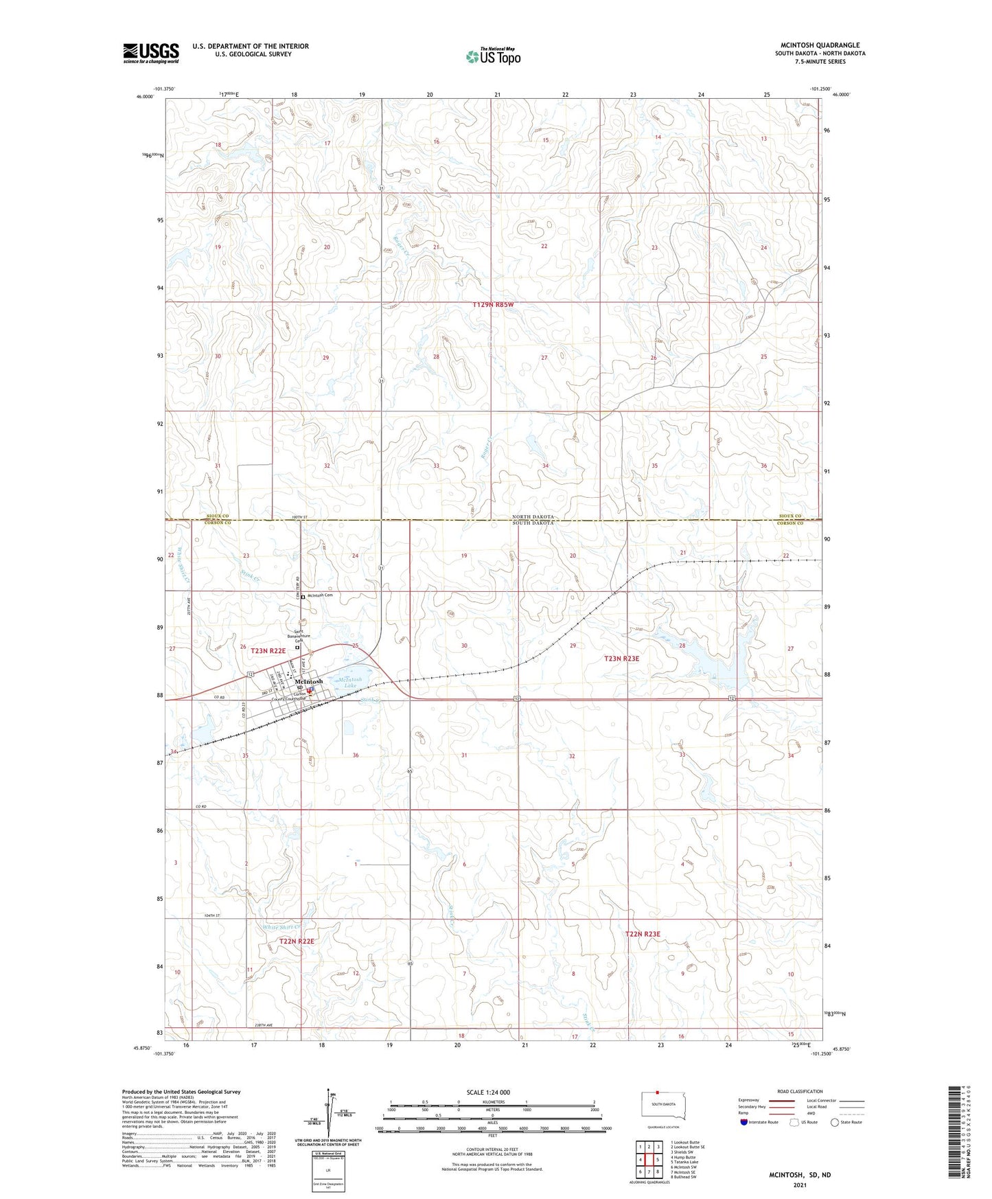
2021 topographic map quadrangle McIntosh in the state of South Dakota. Scale: 1:24000. Based on the newly updated USGS 7.5' US Topo map series, this map is in the following counties: Corson, Sioux. The map contains contour data, water features, and other items you are used to seeing on USGS maps, but also has updated roads and other features. This is the next generation of topographic maps. Printed on high-quality waterproof paper with UV fade-resistant inks.
Quads adjacent to this one:
West: Hump Butte
Northwest: Lookout Butte
North: Lookout Butte SE
Northeast: Shields SW
East: Tatanka Lake
Southeast: Bullhead SW
South: McIntosh SE
Southwest: McIntosh SW
This map covers the same area as the classic USGS quad with code o45101h3.
Contains the following named places: City of McIntosh, Corson County Courthouse, Corson County Sheriff's Office, Herbert Stoick Dam, Mc Intosh Municipal Airport, McIntosh, McIntosh Cemetery, McIntosh Elementary School, McIntosh High School, McIntosh Junior High School, McIntosh Lake, McIntosh Lake Dam, McIntosh Police Department, McIntosh Post Office, McIntosh Volunteer Ambulance Service, McIntosh Volunteer Fire Department, Pudwell Dam, Saint Bonaventure Cemetery, Township of Lake