MyTopo
Lostwood Lakes North Dakota US Topo Map
Couldn't load pickup availability
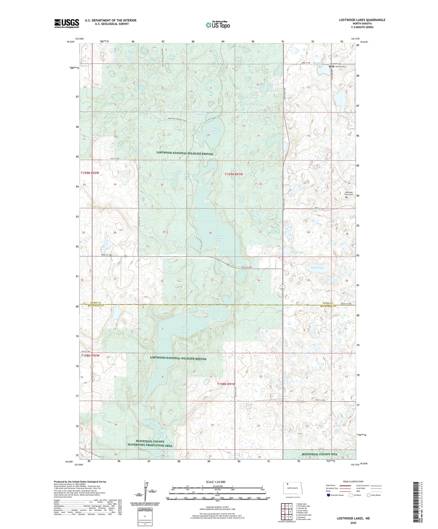
2024 topographic map quadrangle Lostwood Lakes in the state of North Dakota. Scale: 1:24000. Based on the newly updated USGS 7.5' US Topo map series, this map is in the following counties: Burke, Mountrail. The map contains contour data, water features, and other items you are used to seeing on USGS maps, but also has updated roads and other features. This is the next generation of topographic maps. Printed on high-quality waterproof paper with UV fade-resistant inks.
Quads adjacent to this one:
West: Lunds Valley
Northwest: Helde Lake
North: Thompson Lake
Northeast: Vanville NE
East: Westby Lake
Southeast: Clearwater Lake
South: Lostwood
Southwest: Cottonwood Lake
This map covers the same area as the classic USGS quad with code o48102e4.
Contains the following named places: Dead Dog Slough, Eds Slough, Hide and Stone Cemetery, Kittelson Slough, Knudson Slough, Lostwood Lakes, Lostwood National Wildlife Refuge, Lower Lostwood Lake, Martinsen Lake, Merrills Slough, Nasareth Cemetery, Neils Slough, Pauls Slough, Rock Slough, Rush Lake, Salon Lake, School Section Lake, Smith Lake, Spring Lake, Spring Slough, Township of Lostwood, Township of Vanville, Upper Lostwood Lake, Vanville Cemetery, Vanville School