MyTopo
Makoti SW North Dakota US Topo Map
Couldn't load pickup availability
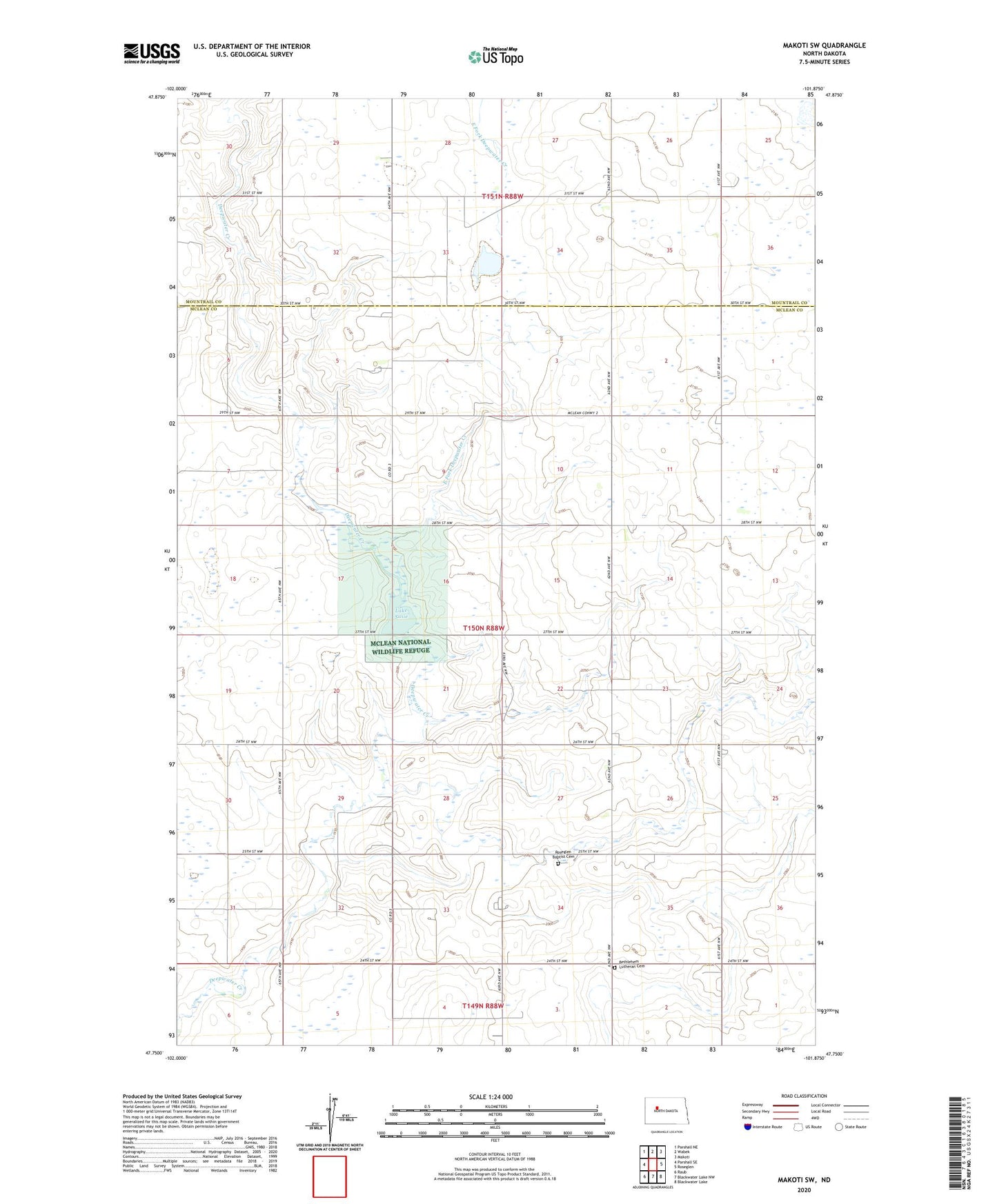
2024 topographic map quadrangle Makoti SW in the state of North Dakota. Scale: 1:24000. Based on the newly updated USGS 7.5' US Topo map series, this map is in the following counties: McLean, Mountrail. The map contains contour data, water features, and other items you are used to seeing on USGS maps, but also has updated roads and other features. This is the next generation of topographic maps. Printed on high-quality waterproof paper with UV fade-resistant inks.
Quads adjacent to this one:
West: Parshall SE
Northwest: Parshall NE
North: Wabek
Northeast: Makoti
East: Roseglen
Southeast: Blackwater Lake
South: Blackwater Lake NW
Southwest: Raub
This map covers the same area as the classic USGS quad with code o47101g8.
Contains the following named places: Bethlehem Lutheran Cemetery, Diffley Landing Strip, East Fork Deepwater Creek, Lake Susie, Lake Susie Dam, Lake Susie National Wildlife Refuge, McLean National Wildlife Refuge, Roseglen Baptist Cemetery, Township of Amundsville, Wright School