MyTopo
Marmarth North Dakota US Topo Map
Couldn't load pickup availability
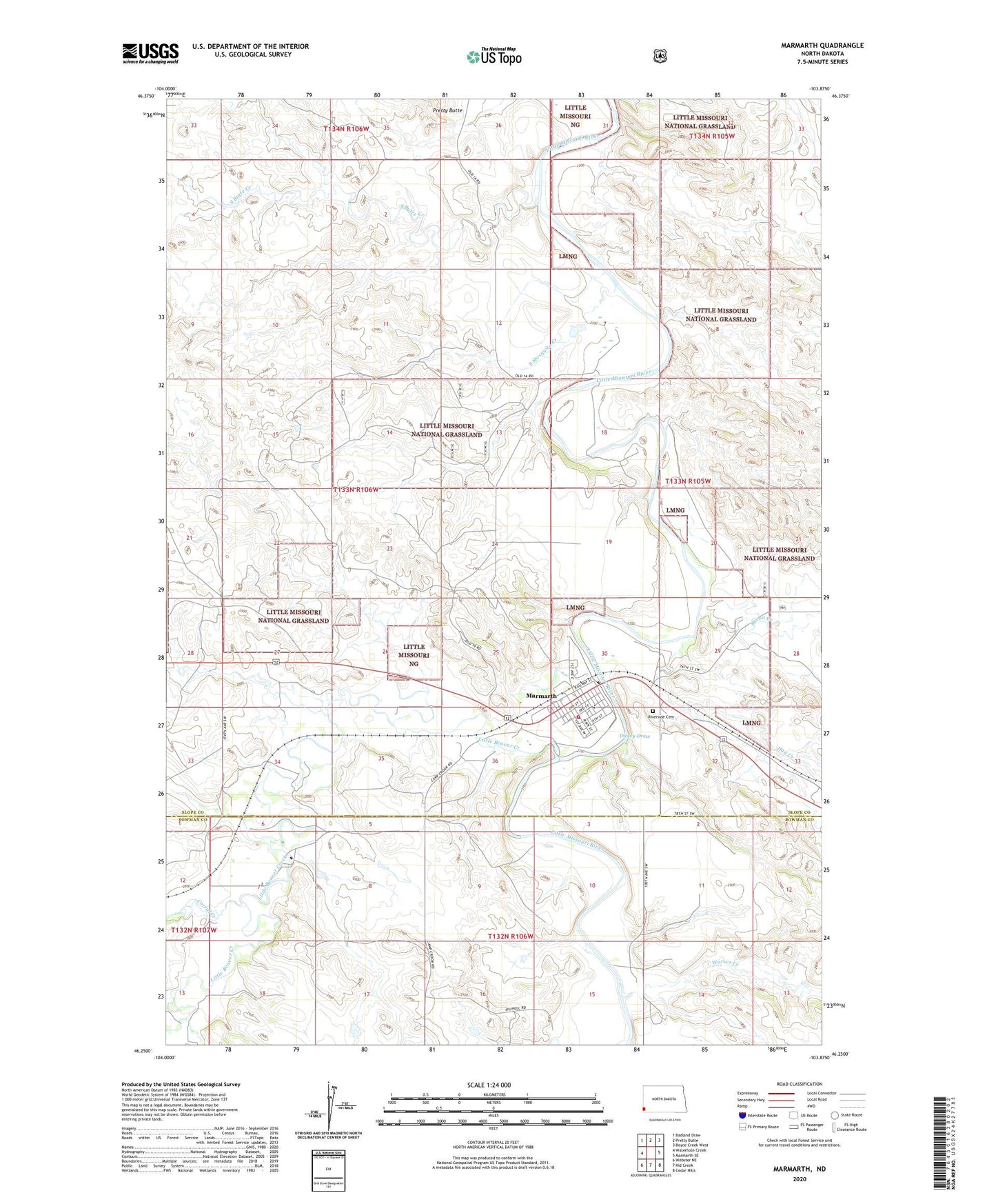
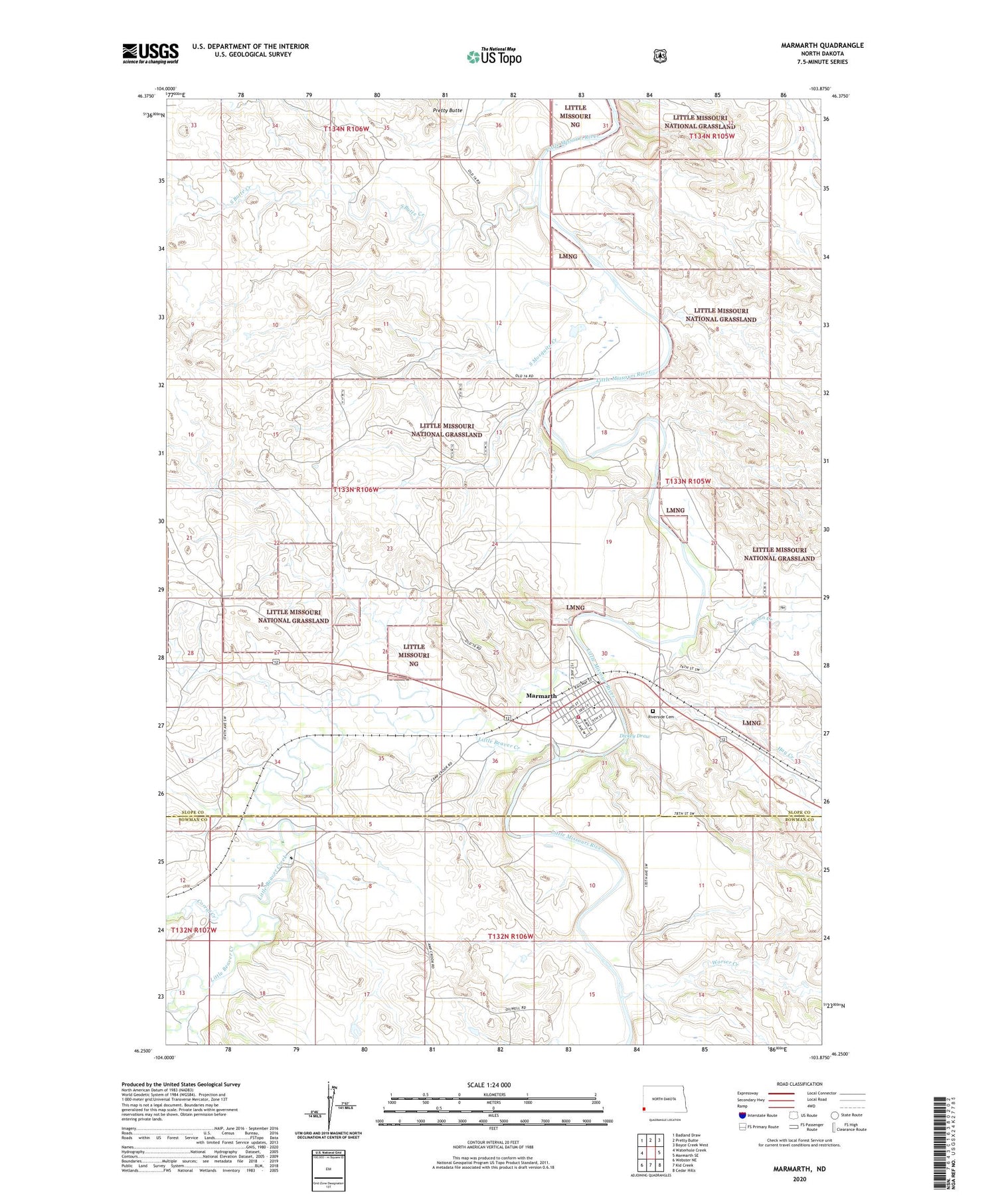
2020 topographic map quadrangle Marmarth in the state of North Dakota. Scale: 1:24000. Based on the newly updated USGS 7.5' US Topo map series, this map is in the following counties: Slope, Bowman. The map contains contour data, water features, and other items you are used to seeing on USGS maps, but also has updated roads and other features. This is the next generation of topographic maps. Printed on high-quality waterproof paper with UV fade-resistant inks.
Quads adjacent to this one:
West: Waterhole Creek
Northwest: Badland Draw
North: Pretty Butte
Northeast: Boyce Creek West
East: Marmarth SE
Southeast: Cedar Hills
South: Kid Creek
Southwest: Webster NE
Contains the following named places: Bacon Creek, City of Marmarth, Corral Creek, Dickey Draw, Hay Creek, Little Beaver Creek, Marmarth, Marmarth Ambulance Service, Marmarth Elementary School, Marmarth Fire Protection District Station, Marmarth Post Office, Riverside Cemetery, South Butte Creek, South Mosquito Creek, Township of Bucklin, Unique Antique Car Museum, Worser Creek, ZIP Code: 58643