MyTopo
Pretty Butte North Dakota US Topo Map
Couldn't load pickup availability
Also explore the Pretty Butte Forest Service Topo of this same quad for updated USFS data
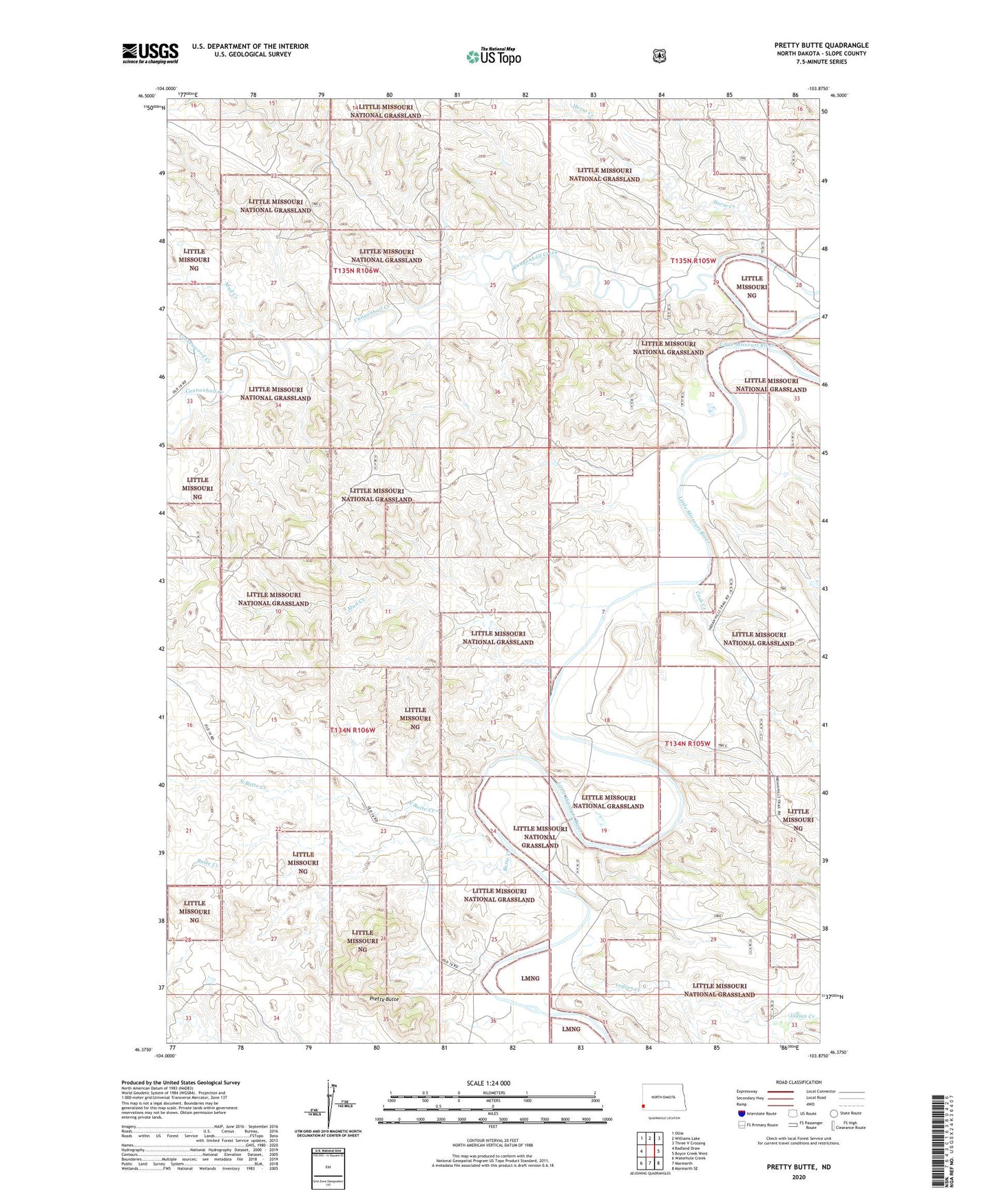
2024 topographic map quadrangle Pretty Butte in the state of North Dakota. Scale: 1:24000. Based on the newly updated USGS 7.5' US Topo map series, this map is in the following counties: Slope. The map contains contour data, water features, and other items you are used to seeing on USGS maps, but also has updated roads and other features. This is the next generation of topographic maps. Printed on high-quality waterproof paper with UV fade-resistant inks.
Quads adjacent to this one:
West: Badland Draw
Northwest: Ollie
North: Williams Lake
Northeast: Three V Crossing
East: Boyce Creek West
Southeast: Marmarth SE
South: Marmarth
Southwest: Waterhole Creek
This map covers the same area as the classic USGS quad with code o46103d8.
Contains the following named places: Brown Ranch, Butte Creek, Cannonball Creek, Cash Creek, Clark Ranch, Cottonwood Creek, Horse Creek, Limber Pine Area, Mud Creek, North Butte Creek, Pretty Butte, Unorganized Territory of West Slope